Albert's Peak
Serving Grants Pass, Merlin and Pleasant Valley at 88.9 MHz
Location: two miles northeast of Grants Pass (geographic coordinates and map).
Albert's Peak was named after the landowner, Henry Albert. His family had owned the property for several generations.
Pictures were taken in September 2008.
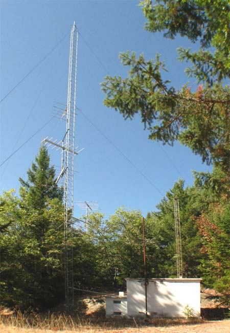
The Radio Facility
This site was far superior to Fielder Mountain. Signal coverage of Grants Pass was improved, commercial electrical power was available, and the translator sat well protected inside an existing concrete building.
At the beginning of KSOR's occupancy, the large tower was used primarily for communications antennas. The KTVL-TV translator and antennas occupied the smaller tower behind the building. In 2008, the KTVL tower is no longer in use, and there are no communications antennas at the site.
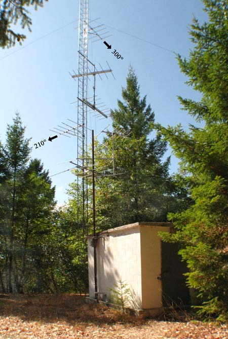
Dual Transmitting Antennas
Arrows were added to this image to identify KSOR's transmitting antennas, and directions were included to correlate with the Relative Field Polar Plot, below. The antennas are unchanged from their original installation.
Documents from the FCC Database
(http://www.fcc.gov/fcc-bin/fmq?list=0&facid=62983)
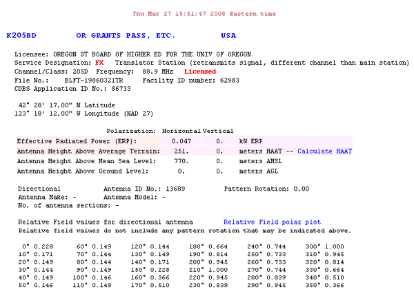
FCC Authorization 2008
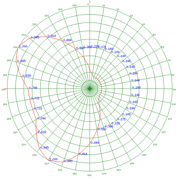
Relative Field Polar Plot 2008
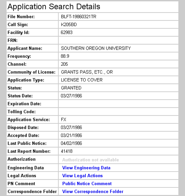
Earliest Recorded License Grant 1986
Topographic Map
Grants Pass Quadrangle, U. S. Geological Survey
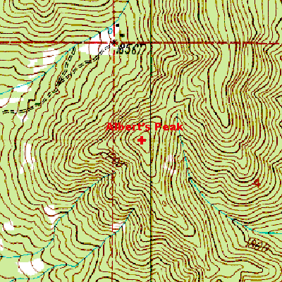
CONTOUR INTERVAL 40 FEET
Geographic Coordinates from the GPS: 42° 28' 18"N, 123° 18' 17"W (NAD27)
Antenna Height Above Mean Sea Level: 770 meters (2,526 feet)