Grizzly Peak (Solar)
Serving Lakeview at 89.5 MHz
Location: 16 miles northwest of Lakeview (geographic coordinates and map).
Pictures were taken in June 2008.
Transmitting Antenna
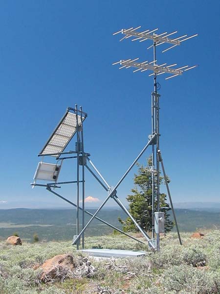
Mount Shasta peeks through the tower structure from the distance. All of the original items are present in this picture as well as a number of things that were added later.
The translator was an XL1-FM solar model providing one watt of output power. A single transmitting antenna provided coverage of Lakeview.
The upper CL-FM antenna and the upper solar array were there from the start. The lower solar panel and CL-FM antenna, the small yagi antenna and the electric service panel with meter base are recent additions. (What a surprise to discover that Grizzly Peak now has AC power!)
The concrete vault held the storage batteries and the translator. The galvanized steel lid, although visible in this picture, was originally six inches below ground level. We placed a foam insulating board, a sheet of plywood, and a layer of dirt on top of the lid. You would have seen nothing but fresh earth beneath the structure of pipes. The vault was extended to its present height much later.
The objective of the subterranean vault was to achieve temperature stability. Our experience with the Tepco J-317 translators was so horrendous that we happily did anything that offered the possibility of greater reliability – even if we had to dig up a translator in order to perform service work. Considering a total driving time of seven hours for Grizzly Peak (or ten hours for Iron Mountain), a few minutes of digging seemed an easy tradeoff against the possibility of saving even one trip due to improved equipment reliability.
Extreme Wind Speed
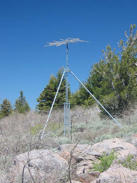
The receiving antenna (above) is located 140 feet northwest of the main structure. It picked up the signal from Stukel Mountain.
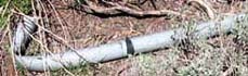 Originally, the upper section of the mast was a full-length 21-foot pipe, placing the antenna several feet above its present height. From the force of the wind alone, a winter storm bent the mast over just above the point supported by the diagonal braces. It was repaired with a shorter length of pipe and has remained undamaged. (Based on information from Todd Cory, email, June 16, 2008)
The mountain is thick with brush, but has only a sparse population of small trees. Antennas and towers are subject to the full force of winter storm winds. Additionally, on the north and east sides, the mountain has large, steep faces (map) that are a perfect setting for the Venturi effect to create extreme winds. The collapse of the receiving-antenna tower is convincing evidence. In addition, the vertical supports behind the solar panels are slightly bent, as one can see from the photograph at the top of this page. Some wind!
Documents from the FCC Database
(http://www.fcc.gov/fcc-bin/fmq?list=0&facid=63000)
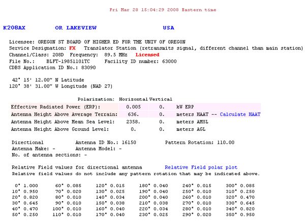
FCC Authorization 2008
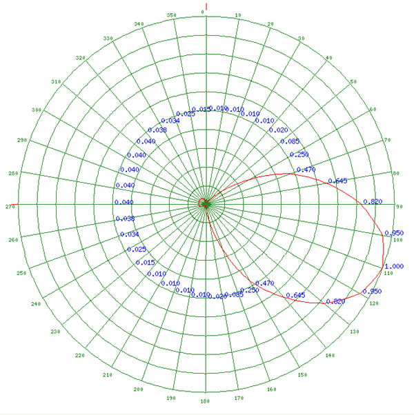
Relative Field Polar Plot 2008
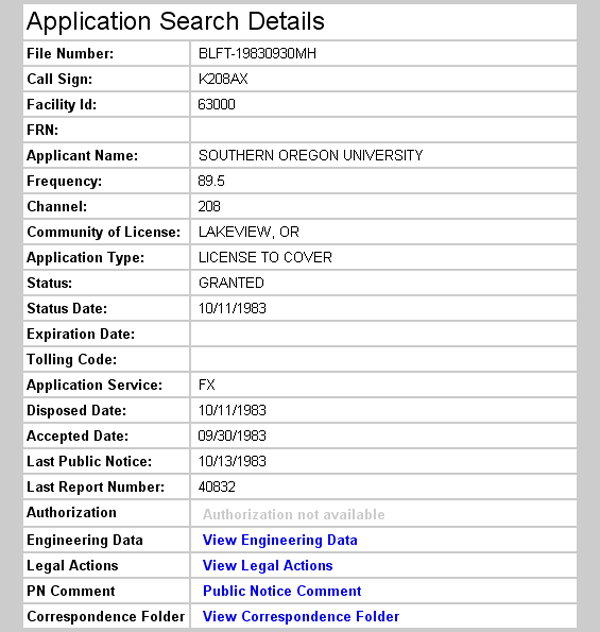
Initial License Grant 1983
Topographic Map
Cougar Peak Quadrangle, U. S. Geological Survey
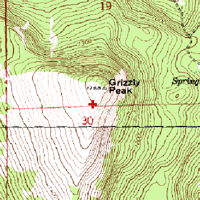
CONTOUR INTERVAL 20 FEET
Geographic Coordinates from the GPS: 42° 15' 5"N, 120° 38' 21"W (NAD27)
Antenna Height Above Mean Sea Level: 2,354 meters (7,724 feet)