The Harbor Hills
Serving Brookings and Harbor at 91.1 MHz
Location: two miles east of Brookings and one-half mile south of Harbor Peak (geographic coordinates and map).
Pictures were taken in April 2008.
The Transmitting Antenna
When installed, this mast extended more than 15 feet above the ground. It appears that earth later removed by excavating for new radio buildings and towers was distributed beneath both of the original translator antennas.
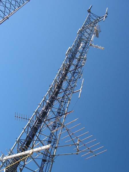
The antenna was positioned to broadcast westwards to Brookings, and the Tepco J-317 translator resided in a steel box mounted on the tower. Now, the antenna is directed southeast in order to receive the signal from the Camp Six translator. The signal arriving from King Mountain is weak, noisy and unsuitable for translation, but the signal from Camp Six is strong and clear.
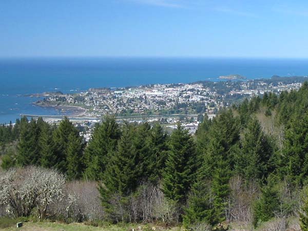
Signal Coverage
This site does not offer a direct view of the entire community. The translator is close enough and high enough above the city, however, that the signal bounces well into shadowed areas. In marked contrast, the translator in Crescent City broadcasts from an antenna less than 90 feet above sea level. There, the signal penetration of shadowed areas is extremely poor.
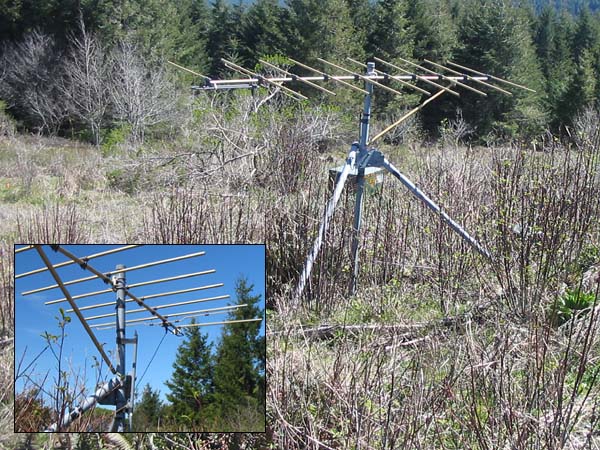
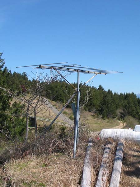
The Receiving Antenna
The signal arrived from Crescent City, 20 miles to the south. The antenna was placed 70 feet east of the transmitting antenna. Steel conduit, buried between the transmitting and receiving antenna towers, housed the RG-11 coaxial cable that connected the receiving antenna. As seen in the photo inset, the original coaxial cable has been cut and the rear element (reflector) of the antenna is broken.
Each of the three pipes supporting the antenna is 21 feet in length. Several feet of rock and earth have been added since the installation.
Operation in 2008
The translator now broadcasts from an antenna mounted on this tower (lower right-hand side).
Documents from the FCC Database
(http://www.fcc.gov/fcc-bin/fmq?list=0&facid=62998)
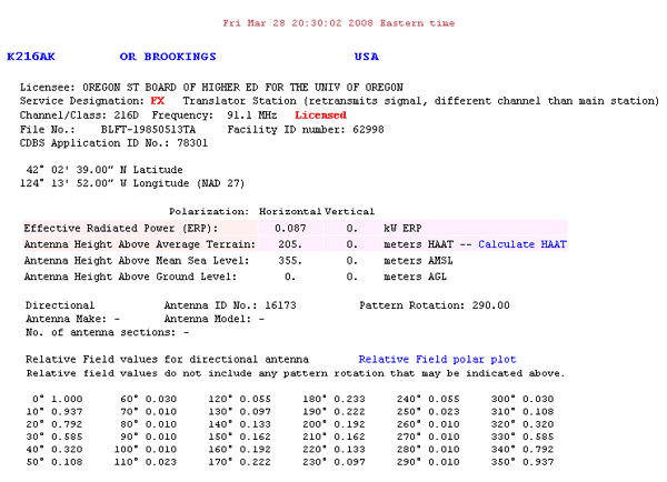
FCC Authorization 2008
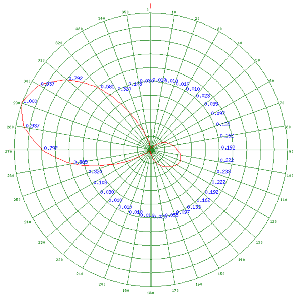
Relative Field Polar Plot 2008
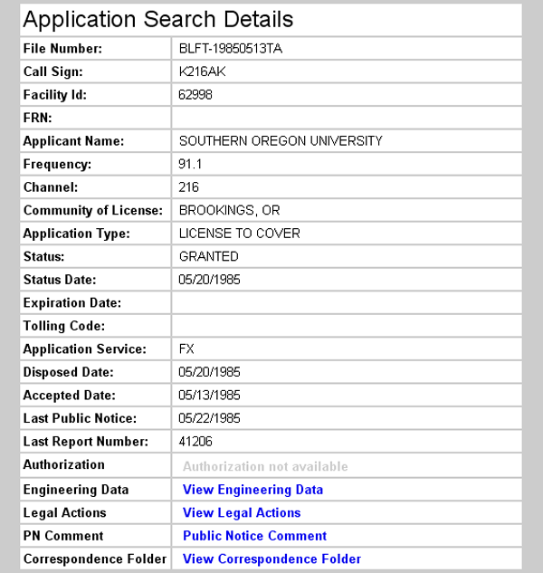
Initial License Grant 1985
Topographic Map
Mount Emily Quadrangle, U. S. Geological Survey
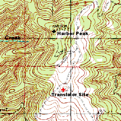
CONTOUR INTERVAL 40 FEET
Geographic Coordinates from the GPS: 42° 2' 44"N, 124° 14' 1"W (NAD27)
Elevation: 1141 feet (348 meters) AMSL