Kenyon Mountain
Serving Camas Valley at 88.7 MHz
Location: 5.5 miles southwest of Camas Valley and 1.1 mile southeast of the Kenyon Mountain summit (geographic coordinates and map). Kenyon Mountain is also referred to as Signal Tree.
Pictures were taken in March 2008.
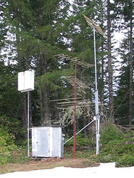
Municipal Translator Building
The transmitting antenna for KSOR is on the tall tower on the right. When installed, the antenna elements were horizontal. The 45-degree rotation was subsequent to KSOR's transmitter being moved to King Mountain.
The white box on a pole is a microwave antenna, and the other antennas are for TV translators. A small antenna is beyond the picture on the left, and the KSOR receiving antenna is beyond the picture on the right.
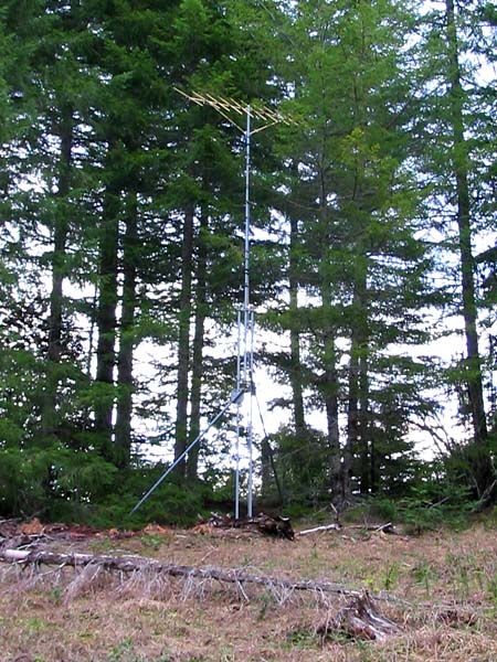
Receiving Antenna
This antenna picked up the signal from the translator on Scott Mountain. It was installed with the elements positioned horizontally.
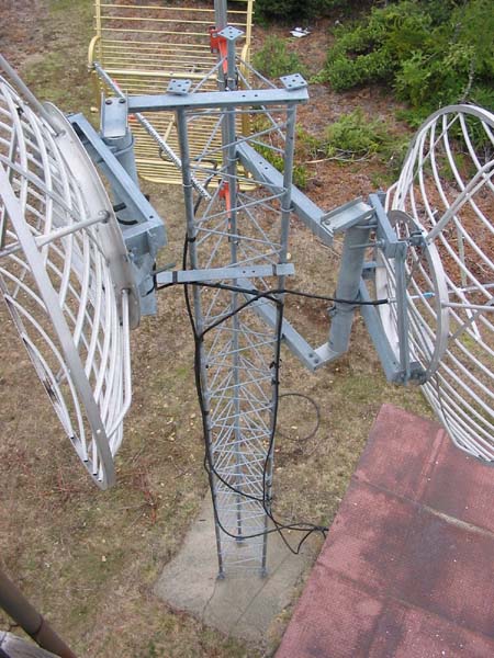
At the Summit (map)
This tower was installed after the KSOR transmitting facility was moved to King Mountain in 1987. The 2,000-watt transmitter that had served at Mt. Baldy for ten years was moved to Stukel Mountain and began broadcasting as KSKF to the Klamath Falls area.
The 80-foot tower at Mt. Baldy had been assembled from four 20-foot sections. When decommissioned, the tower was removed, and one of the 20-foot sections was used here to support two microwave antennas for KSBA in Coos Bay.
KSBA was put on the air in 1989. A studio-transmitter link (STL) connected the studios in Ashland to the KSBA transmitter. The STL microwave signal was first relayed at King Mountain and then here at the Kenyon Mountain summit. The two parabolic antennas on opposite sides of the tower were a part of that STL. The gold colored antenna is unrelated.
The summit has become crowded. In addition to the original fire lookout tower, there are now 11 radio towers plus a small weather-instrument tower.
Documents from the FCC Database
(http://www.fcc.gov/fcc-bin/fmq?list=0&facid=63018)
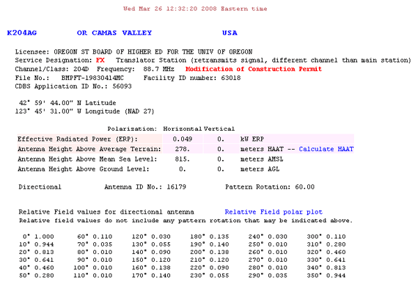
FCC Authorization 2008
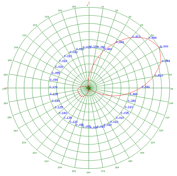
Relative Field Polar Plot 2008
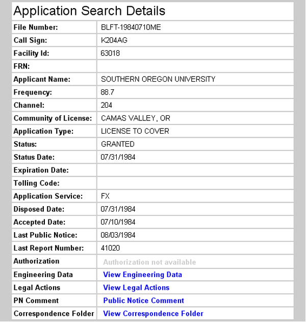
Initial License Grant 1984
Topographic Map
Kenyon Mountain, Bone Mountain, Camas Valley and Chipmunk Ridge Quadrangles
U. S. Geological Survey
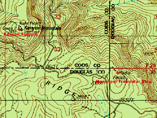
CONTOUR INTERVAL 40 FEET
Geographic Coordinates for the Translator Building: 42° 59' 46"N, 123° 45' 32"W (NAD27)
Antenna Height Above Mean Sea Level: 814 meters (2,670 feet)