Loma Linda Drive
Serving Klamath Falls and Altamont at 90.5 MHz
Location: adjacent to the municipal water tank at the northern end of Loma Linda Drive (geographic coordinates and map).
Pictures were taken in March 2008.
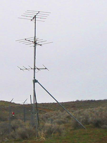
Transmitting Antennas
Three antennas spread the signal over an arc of 180 degrees, from the north end of Klamath Falls to the east end of Altamont. The small metal box just above the middle antenna is a three-way power divider manufactured by Scala. The ten watts of radio-frequency power from the translator is divided equally among the three antennas.
The translator is under ground, in a ferrocement vault at the base of the antenna tower.
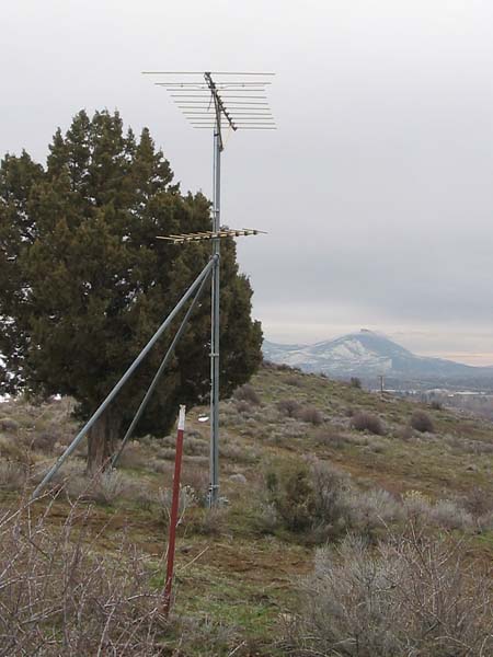
Receiving Antenna
The top antenna belongs to KSOR. It picks up a signal directly from Stukel Mountain, visible in the distance.
The lower antenna picks up KTVL Channel 10 TV directly from Mt. Ashland. Their translator is nearby.
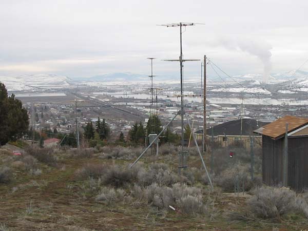
The View South
We see the Kingsley Field air base and Lake Ewauna. Altamont is beyond the left edge of the picture, and most of Klamath Falls is beyond the right edge. The KTVL translator is between the KSOR transmitting antennas in the foreground and receiving antenna in the distance.
Documents from the FCC Database
(http://www.fcc.gov/fcc-bin/fmq?list=0&facid=63008)
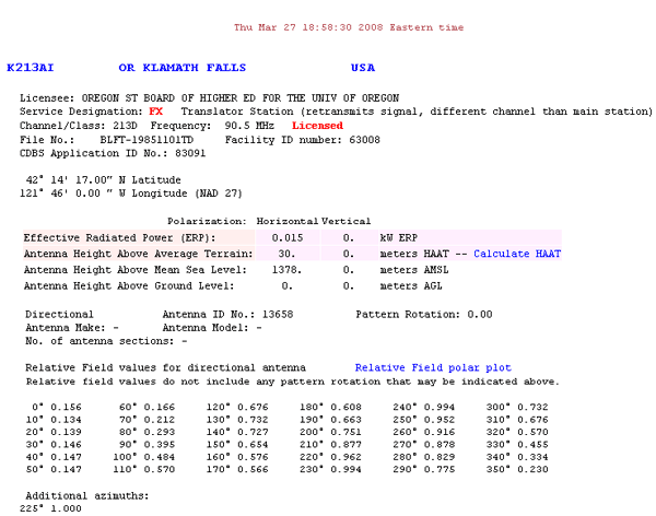
FCC Authorization 2008
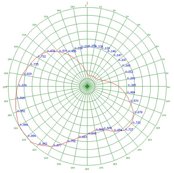
Relative Field Polar Plot 2008
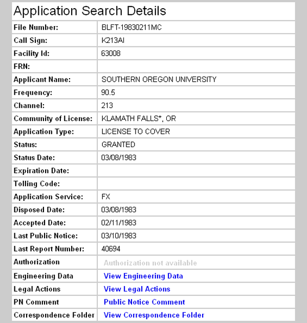
Initial License Grant 1983
Topographic Map
Klamath Falls Quadrangle, U. S. Geological Survey
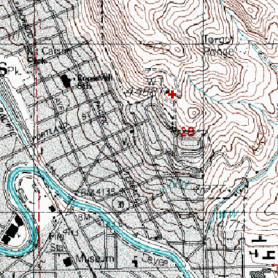
CONTOUR INTERVAL 20 FEET
Geographic Coordinates: 42° 14' 17"N, 121° 46' 00"W (NAD27)
Antenna Height Above Mean Sea Level: 1,378 meters (4,521 feet)