Mount Nebo
Serving Roseburg at 90.1 MHz
Location: adjacent to Roseburg on the southwest side (geographic coordinates and map).
Picture was taken in February 2008.
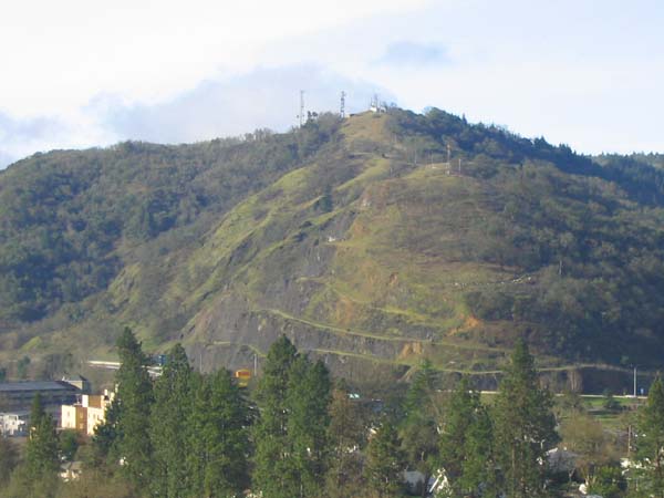
The Translator Site on Mount Nebo
There was only one building when the translator was installed. The excellent coverage of Roseburg from this site has attracted a number of new broadcast and communications facilities. The white line running across the picture at the base of Mount Nebo is Interstate 5 (I-5).
The Famous Mount Nebo Goats
On a grassy hillside near Roseburg, there once lived a band of wild goats who gained national attention for their uncanny ability to predict the weather. . . .
If the goats were high on the hillside, fair weather was predicted. If they were grazing down by Interstate 5, one could assume stormy skies were the order of the day . . . over time the goats proved to be 99 percent accurate as opposed to the 60 percent accuracy rate of the [National Weather Service]. . . .
If the herd was grazing topside, disc jockeys [at radio station KRSB] announced a “High Goat Day,” with sunny weather expected. If the herd was spread out on the hillside, “Widely Scattered Goats” meant partly sunny skies with a chance of showers. But if the goats came down to the bottom of Mount Nebo, “Low Goat Pressure” was declared — and listeners were advised to bring their brollies. . . . (Sanne Specht, "Star Grazers, Mount Nebo's Weather Goats," Our Valley – Would You Believe?, 2006, from the Mail Tribune website: http://www.our-valley.com/2006/, August 31, 2008.)
Documents from the FCC Database
(http://www.fcc.gov/fcc-bin/fmq?list=0&facid=62969)
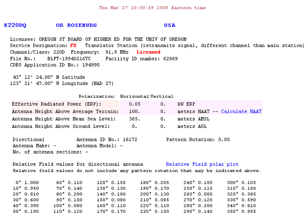
FCC Authorization 2008
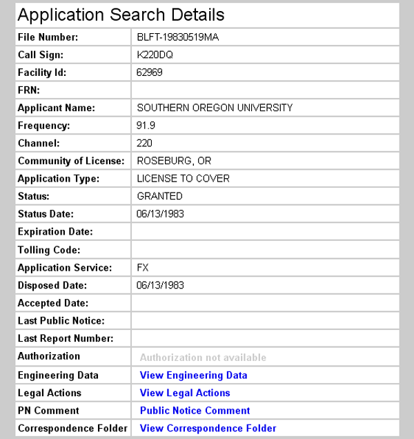
Initial License Grant 1983
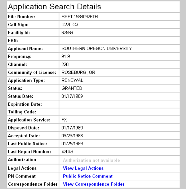
Frequency Change 1989
Errors in the FCC Database
The Original Construction Permit is dated April 30, 1979, but a station license isn't recorded until 1983. Because the Nebo translator provided the signal for the Scott Mountain translator, which was licensed on September 11, 1979, it appears that the first license grant may be missing from the Nebo record.
At present (2008), the translator operates on a frequency of 91.9 MHz, which coincides with the authorization recorded in the FCC Database. When first placed on the air, however, it transmitted on 90.1 MHz, relaying the 91.9 MHz signal from Canyon Mountain.
From the beginning, the Canyon Mountain translator operated on 91.9 MHz. Because the Mount Nebo translator was never licensed as a booster station (broadcasting and receiving on the same frequency), the FCC Search Details for the license granted on June 13, 1983 incorrectly record the operating frequency as 91.9 MHz.
KSOR's main transmitter, when located on Mt. Baldy near Medford, could not possibly interfere with the Mount Nebo translator operating on the same frequency. The distance and the mountainous terrain effectively isolated the two sites. In 1987, however, after the main transmitter was moved north to King Mountain, and the power was increased from 2,000 to 38,000 watts, there was a certainty of interference. It was then imperative to change the operating frequency of the Mount Nebo translator. The 1989 license renewal correctly records the new operating frequency of 91.9 MHz.
Topographic Map
Roseburg East Quadrangle, U. S. Geological Survey
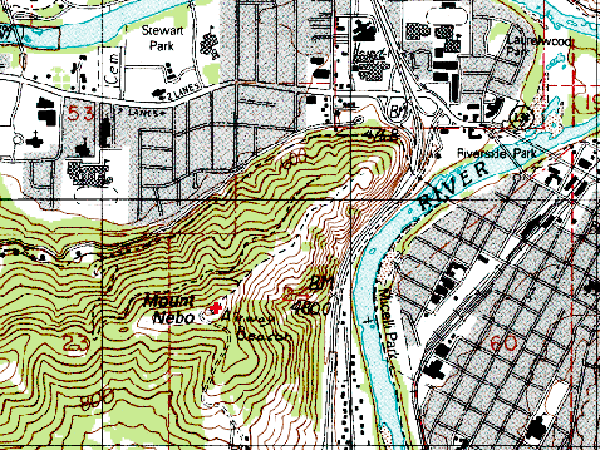
CONTOUR INTERVAL 40 FEET
Geographic Coordinates: 43° 12' 24"N, 123° 21' 47"W (NAD27)
Antenna Height Above Mean Sea Level: 362 meters (1,188 feet)