Coast Guard Hill
Serving Port Orford at 90.5 MHz
Location: the municipal translator building located within Tichenor Cemetery on Coast Guard Hill, also known as Spy Glass Hill (geographic coordinates and map). In 2008, the entrance is on private property.
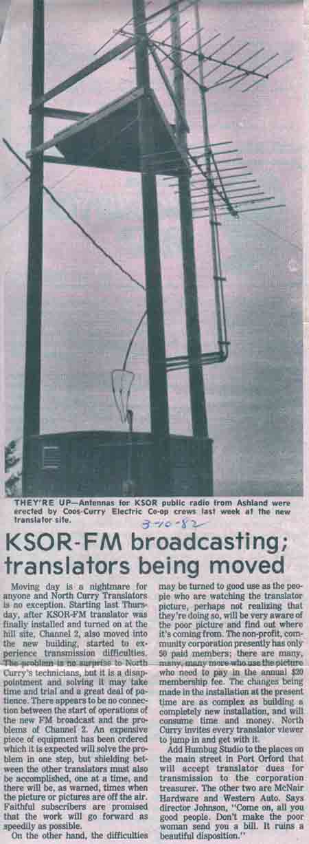
Pictures as well as articles from the Port Orford News and the KSOR Guide, all from 1982, were provided by Alan Mitchell of Port Orford.
Transmitting Antennas
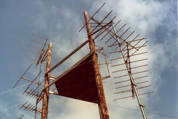
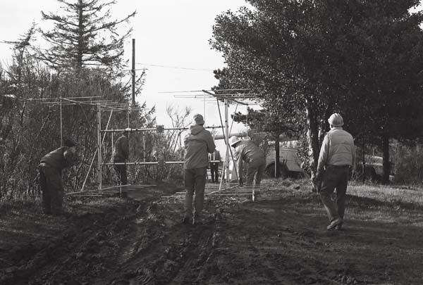
A triad of wood poles supported a multitude of antennas for TV translators. Two ten-element yagi antennas for KSOR were side-mounted on the right-hand pole.
The First Antennas
The KSOR transmitting antennas were the first to be installed at the new translator facility. This article appeared in the Wednesday, March 10, 1982 edition of the Port Orford News.
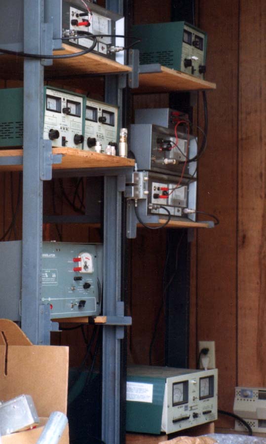
Inside the Translator Building
KSOR's XL10-FM2 translator is on the bottom, right side. The other units are television translators.
Selecting a Receiving Antenna
The Iron Mountain translator, 19 miles to the east, provided the link between the Mt. Baldy transmitter and Port Orford. In the planning stage, we were concerned about the signal path between Iron Mountain and Port Orford.
We would have preferred a line-of-sight path. Often, it had been said that radio signals behave most dependably when there is no obstruction between the transmitter and the receiver. (Later experience with the translator network revealed that this is not always true.)
Today, a computer could easily determine the particulars of the signal path, but we did map analysis by hand. We taped 15-minute topographic maps together on a large floor and used a taut string to determine the signal path. We found two mountain peaks blocking the view. From the map data, we calculated the change in direction at each peak. The total was slightly less than two degrees.
Lessons from Experience
A radio signal does bend very slightly when passing over a mountaintop or ridge, but looses strength in doing so. In physics, this phenomenon is called knife-edge diffraction. Using light, the effect can be calculated and proven in a simple laboratory setting, but the actual path for any radio signal involves irregular terrain that has little resemblance to either a laboratory environment or the simplicity of a mathematical model.
We had measured the signal from Mt. Baldy over three different paths having knife-edge diffraction, but this seemed a small and imprecise database for making predictions. At the time of planning the Port Orford translator, we had no authoritative information on the subject.
The fact that the path to Port Orford had two points of knife-edge diffraction, not just one, added to the uncertainty. Also, we had been advised that radio signals demonstrate increased variability in coastal climates. It seemed prudent to increase the power (or gain) of the receiving antenna. We chose a quad antenna array, shown in the picture immediately below, which was designed for cable TV systems. Understandably, it offered a power of four times that of a single antenna.
Years later, after having made a large number of field measurements, we learned that the effect of knife-edge diffraction is quite predictable, even over irregular terrain. The large database confirmed that the original observations would have been sufficiently accurate and that the warning about increased signal variability in coastal climates was unwarranted.
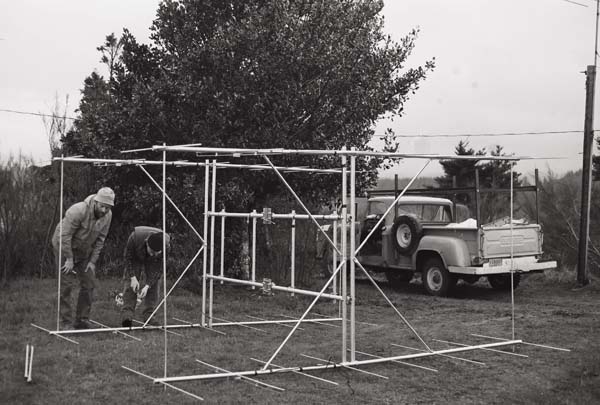
After assembly, John Patton and John Bach (the KSOR crew) prepare to hoist the receiving antenna array into position.
A wood pole for receiving antennas had been set south of the new translator building. While carrying the antenna from the assembly area, care was taken to avoid bending the fragile elements.
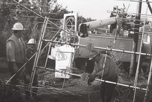
Curt Brown, Dennis Bodewig and Jack Lennox from the Coos-Curry Electric Cooperative (CCEC) prepared to lift the antenna with their boom truck.
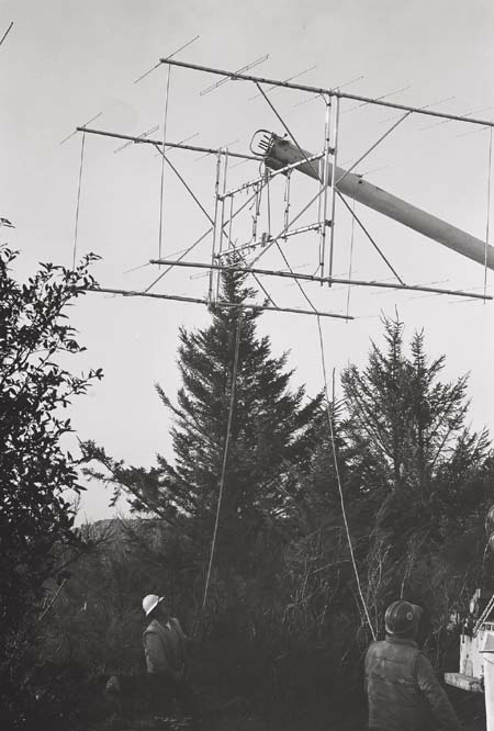
Curt Brown and Jack Lennox (CCEC) held the antenna in position while it was being hoisted.
The boom truck did not have sufficient reach to set the antenna in place. Jack Lennox (CCEC, lower) and John Patton (KSOR, upper) prepared to lift the antenna into position.
A 21-foot length of two-inch galvanized pipe had been mounted at the top of the wood pole. The steel box below Jack Lennox's feet housed the antenna preamplifier. Coaxial cable ran to the translator building within steel conduit.
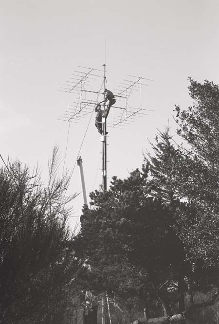
A rope running through a pulley higher on the antenna mast enabled the ground crew to carry the weight of the array while it was wrestled into place.
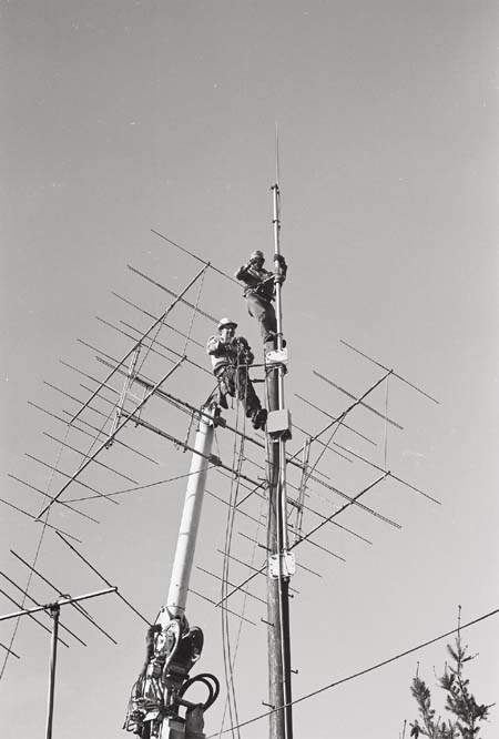
A lightning rod had been installed because the quad array was the highest metallic object in the vicinity. A solid copper wire ran from the lightning rod to a ground rod directly below, and was bonded to the preamplifier box and steel conduit.
Performance of the Quad Array
One winter day, we received a call from Port Orford. There had been a storm, and half of the antenna array had broken loose and fallen to the ground. The antenna was designed to provide radiofrequency gain at a moderate price, but proved inadequate for coastal winds.
We replaced the antenna with a single Scala HDCA-10. The new antenna demonstrated adequate gain and has endured well in this environment.
Documents from the FCC Database
(http://www.fcc.gov/fcc-bin/fmq?list=0&facid=62988)
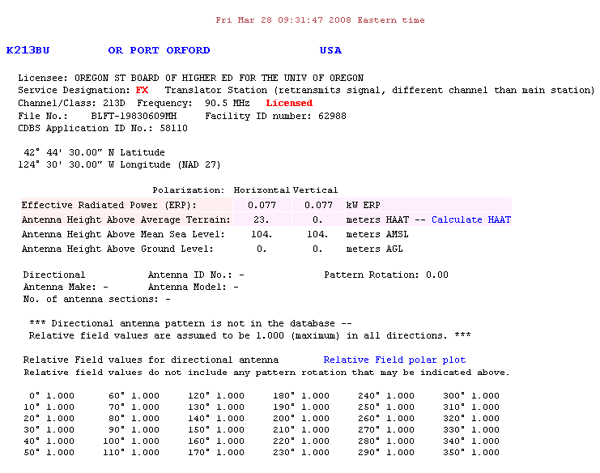
FCC Authorization 2008
The FCC Database does not include directional antenna data for this translator.

Application Search Results – 2008
(http://fjallfoss.fcc.gov/cgi-bin/ws.exe/prod/cdbs/pubacc/prod/app_list.pl?Facility_id=62988)
Initial License Grant for Port Orford
The Application Search Results of the FCC Database (just above) appear to date the initial License to Cover incorrectly:
The original Construction Permit is dated January 29, 1980, followed by a Major Modification to a Construction Permit on January 25, 1983, and an application for a Major Modification to a Licensed Facility on May 3, 1983.
Based on these Search Results, one would expect the granting of the first License to Cover between January 25 and May 3, 1983, but the earliest recorded date is July 6, 1983. More than one date listed in the Search Results is questionable.
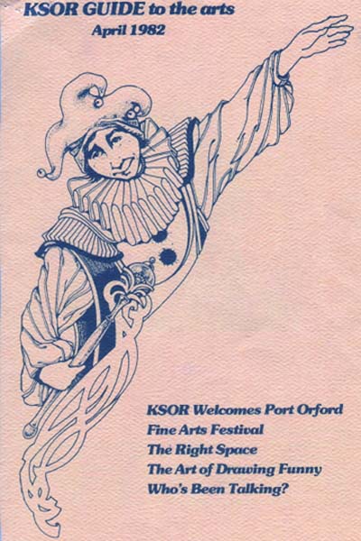
Two items suggest March 1982 for the initial license grant. The article from the Port Orford News (above) states that the KSOR translator was activated on Thursday, March 4, 1982. The KSOR Guide to the Arts (below) extends a word of welcome to Port Orford in the April 1982 issue.
Topographic Map
Port Orford Quadrangle, U. S. Geological Survey
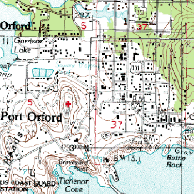
CONTOUR INTERVAL 40 FEET
Geographic Coordinates: 42° 44' 43"N, 124° 30' 8"W (NAD27)
Antenna Height Above Mean Sea Level: 96 meters (315 feet)