Park Mountain (Solar)
Serving Weed, Lake Shastina and Gazelle at 89.5 MHz
Location: eight miles west of Weed, five miles southwest of the Weed Airport (geographic coordinates and map).
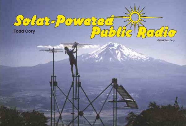
Panorama Incomparable
The view from the Park Mountain translator is breathtaking. Work proceeds on an antenna with Mt. Shasta as the backdrop. This image is from the article by Todd Cory, "Solar-Powered Public Radio," Home Power Magazine, February/March 1998. Used with permission of the author.
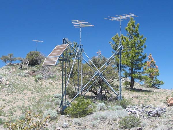
Main Tower
The structure supports two transmitting antennas and the solar panels. The translator and batteries are in ferrocement vaults underground. The receiving antenna is in the distance. This and the following photographs were taken in June 2008.
The translator was an XL1-FM2 solar-optimized model with dual one-watt output modules.
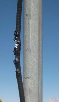
Vandalism
Someone used the transmitting coaxial cable for target practice. The coax was damaged about five feet above ground on the northeastern leg of the main tower.
We didn't place the coaxial cable in steel conduit for the transmitting antennas. Instead, we used Heliax, a rigid, low-loss cable manufactured by Andrew Corporation. It was slightly more efficient in delivering power to the antennas.
Although one can't eliminate all vandalism, this incident affirms the benefit of using standard coaxial cable protected by steel conduit. We did use conduit for the solar panel wiring and the coaxial cable for the receiving antenna.
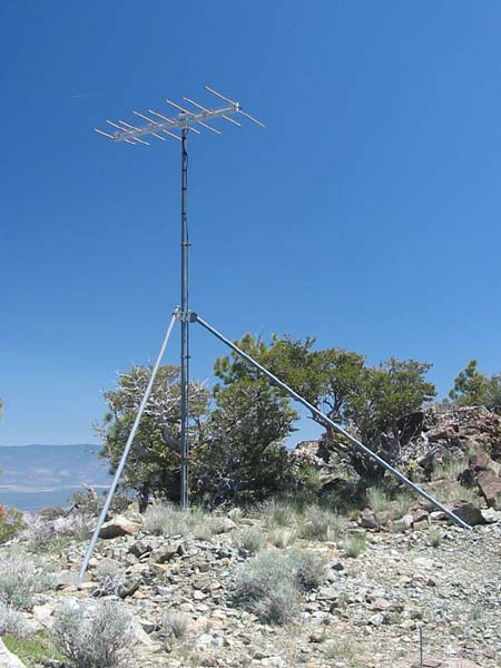
Receiving Antenna
This antenna picked up the signal from the Chestnut Mountain translator. It is located near the highest point of Park Mountain, 135 feet west of the main tower structure.
Lightning
In retrospect, it seems that the receiving antenna would be especially vulnerable to damage from a lightning strike.
There was no protection against lightning other than the inherent bonding of all metallic surfaces. Unlike the HDCA antennas, the CL-FMs attached to the mast with an insulating block. Therefore, the antennas at this site were not connected directly to the common steel structure. Each antenna was grounded only where its coaxial cable connected to the translator, more than 135 feet away in the case of the receiving antenna. It is surprising that a lightning strike has not induced a destructive surge of electrical current. Nevertheless, there was no lightning damage before 1988 and no obvious evidence of such in 2008.
Indications of lightning have been noticed, however:
. . . when I was up there last (probably about 15 years ago) one of the CLFM's had a arc mark on it from getting struck by lightning. (Todd Cory, email, October 12, 2008)
Documents from the FCC Database
(http://www.fcc.gov/fcc-bin/fmq?list=0&facid=62968)
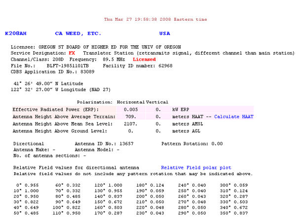
FCC Authorization 2008
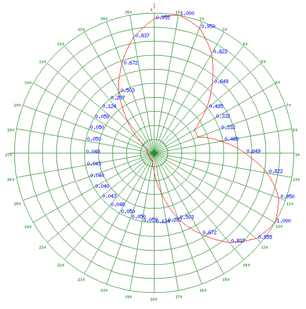
Relative Field Polar Plot 2008
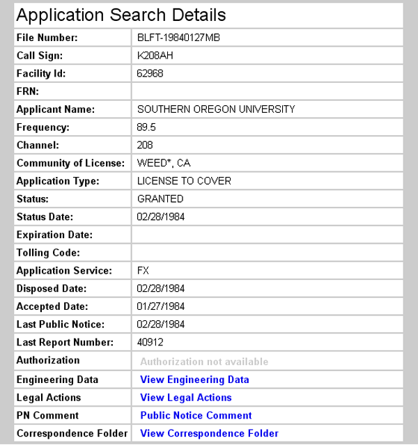
Initial License Grant 1984
Topographic Map
China Mountain Quadrangle, U. S. Geological Survey
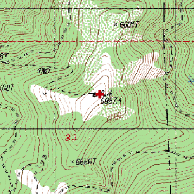
CONTOUR INTERVAL 40 FEET
Geographic Coordinates from the GPS: 41° 26' 51"N, 122° 32' 26"W (NAD27)
Antenna Height Above Mean Sea Level: 2,101 meters (6,892 feet)