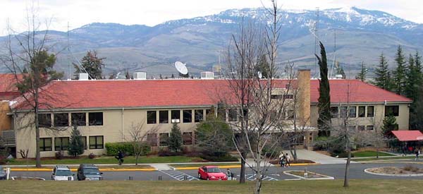
Central Hall
Serving south Ashland and the Dead Indian Memorial Road area at 88.1 MHz
Location: the campus of Southern Oregon State College (SOSC), now named Southern Oregon University (SOU) (geographic coordinates and map).
Pictures were taken in February 2008.
KSOR Operations
Studios and offices were located in the basement of Central Hall. Snowcapped Grizzly Peak is in the background. (The translator for Lakeview was located at its namesake, 105 miles further east.) The transmitter on Mt. Baldy was located eight miles north of Grizzly, beyond the left edge of the picture.
The Ten-Watt Station
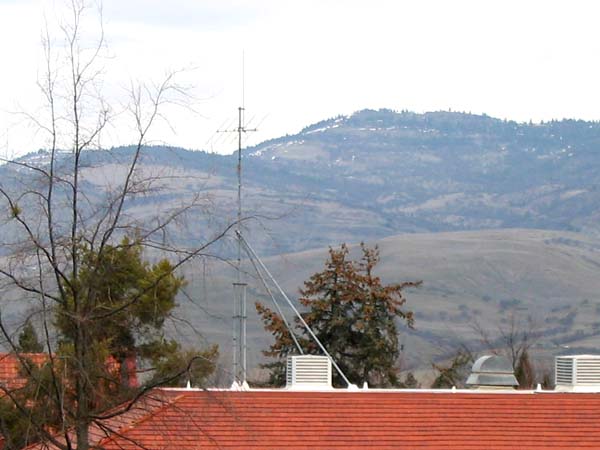
Prior to the transmitter on Mt. Baldy, KSOR was broadcasting with a power of ten watts from a halo antenna located atop this ten-foot mast in the center of the roof. The signal could not be heard in all parts of Ashland.
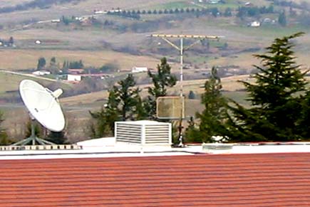
When the Mt. Baldy transmitter first went on the air in 1977, the halo antenna gave way to a Winegard 6065 ten-element receiving antenna used by the new station monitor. The studio-transmitter link (STL) used a Scala Paraflector mounted in the center of the mast to send its microwave signal to Mt. Baldy. There were no other towers or antennas on the roof.
An Improved Receiving Antenna
The signal coming from Mt. Baldy provided program audio for the control room, making it possible to monitor the sound quality actually leaving the transmitter. In addition, a 67 kHz subcarrier provided operating data from the transmitter. The original receiving antenna was unable to support these functions. Multipath reception was distorting the signal.
Multipath is the simultaneous reception of a radio station from more than one direction. It generally includes the signal arriving directly from the transmitter, plus one or more reflections from mountains or buildings. The reflections travel a greater distance, so they arrive a small fraction of a second later. The result is an electronic confusion in the FM receiver that produces distorted audio. If a translator receives a signal degraded by multipath, it rebroadcasts a signal with this same loss of sound quality.
The ridge between Mt. Baldy and Grizzly Peak (visible in the picture at the top of this page) was the source of reflected signals. The distorted reception at Central Hall was unsuitable for either the KSOR control room or the translator.
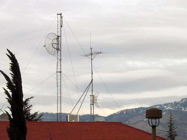
To solve the problem, we took advantage of a phenomenon called circular polarization. Because the transmitting antenna on Mt. Baldy broadcast with circular polarization, we built a matching array with two receiving antennas. The upper antenna from the array remains to this day, as seen in the photo. It was rotated 45 degrees from the horizontal, while a second antenna, mounted below, was rotated 45 degrees in the opposite direction. The antennas were connected with coaxial cables configured as a phasing harness.
Radio waves can't be seen, of course, but with circular polarization, it can be said they spin like a propeller as they travel through the atmosphere. The receiving antenna was designed to pick up the direction of spin coming directly from Mt. Baldy. Where the signal was reflected, the spin reversed, so the receiving array would ignore it. This eliminated the multipath distortion, and with a single antenna array, provided a clear signal for both the control room and the translator.
The Transmitting Antennas
This tower is a mirror image of the tower on the other end of the roof. Originally, it had two antennas: one provided a signal for south Ashland and one for the Dead Indian Memorial Road area. The XL10-FM2 translator sat in the attic space directly under the mast.
Documents from the FCC Database
(http://www.fcc.gov/fcc-bin/fmq?list=0&facid=63007)
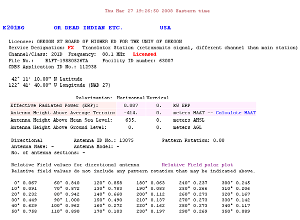
FCC Authorization 2008
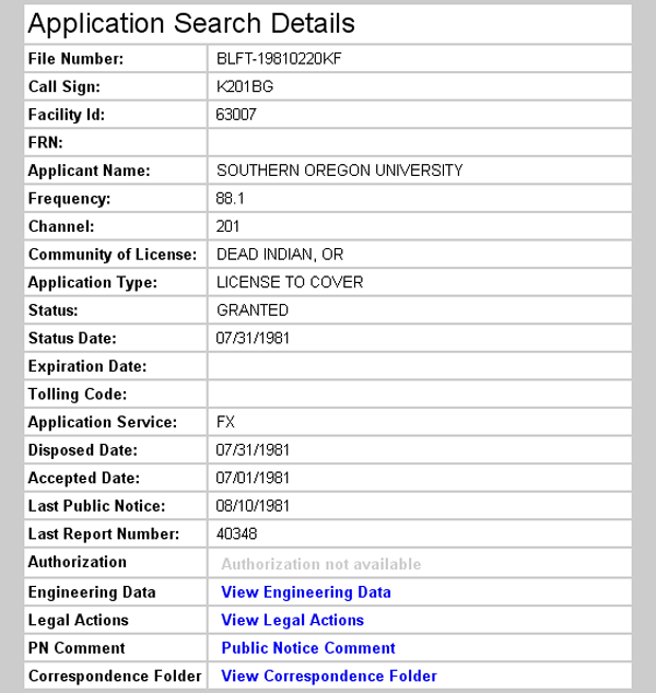
Initial License Grant 1981
Topographic Map
Ashland Quadrangle, U. S. Geological Survey
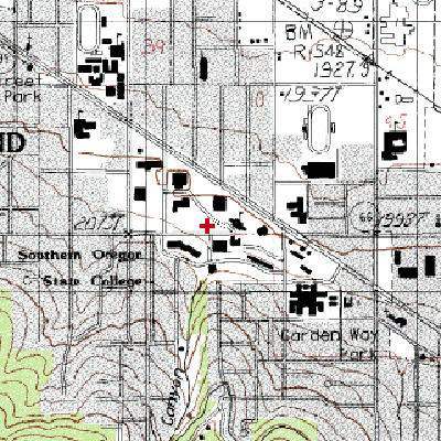
CONTOUR INTERVAL 40 FEET
Geographic Coordinates: 42° 11' 10"N, 122° 41' 40"W (NAD27)
Antenna Height Above Mean Sea Level: 629 meters (2,065 feet)