Stonecypher Butte
Serving Sixes, Denmark and Langlois at 91.3 MHz
Location: six miles northeast of Cape Blanco and four miles inland from the Pacific Ocean (geographic coordinates and map).
Pictures were taken in March 2008.
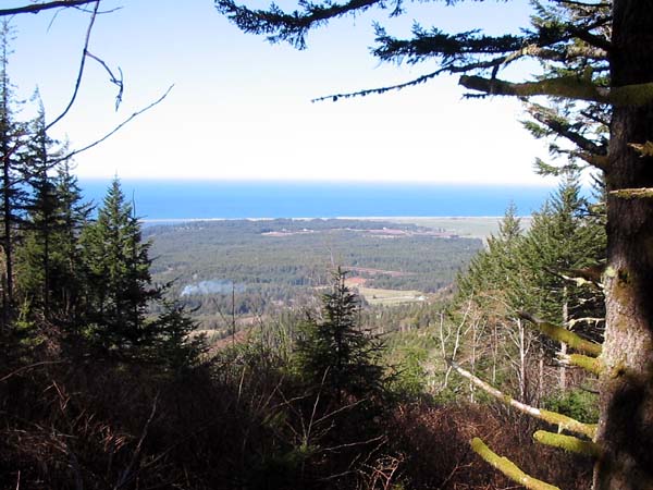
The Setting
Luxuriant vegetation obscures the ocean view in all but a few places. Highway 101 is at the base of the hill.
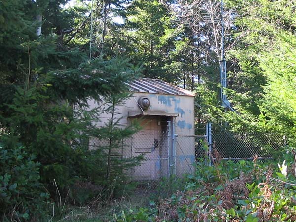
Radio Building
The area around the building was barren of trees and brush in 1984. It's hard to believe this is the same place.
The tower for the transmitting antennas is on the west side of the building (the right side of the picture).
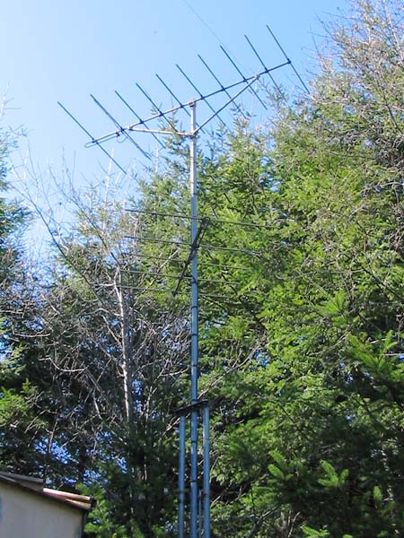
Transmitting Antennas
The translator was a model XL10-FM2. Ten watts of radiofrequency power was delivered to the lower antenna for Sixes and Cape Blanco, and ten watts to the upper antenna for Denmark and Langlois. A clear signal could be heard as far north as the outskirts of Bandon.
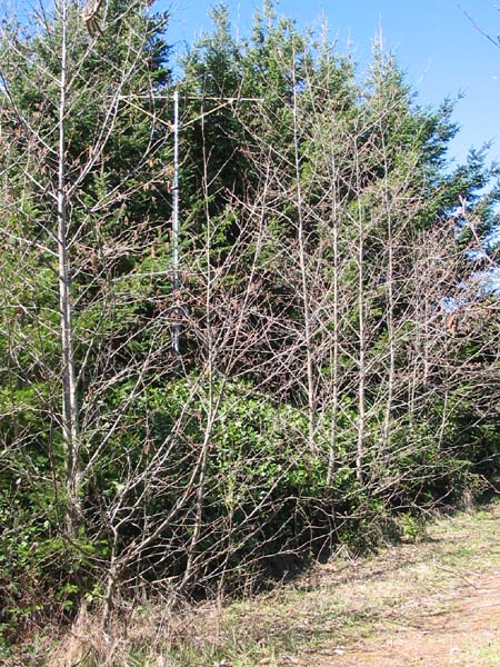
Receiving Antenna
The HDCA-10 yagi was located 120 feet east of the building. It picked up the signal from the Port Orford translator nine miles to the south. The antenna and tower are now being swallowed by vegetation.
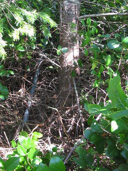
Abundant Growth
There were no trees and no brush here in 1984.
The 1936 Bandon Fire reached as far south as the Sixes River. Logging for fire salvage took place in the 1950s. More recent logging had left the site barren at the time of the translator installation. (Alan Brown, landowner, telephone conversation, June 17, 2008)
Vegetation nearly hides the two-inch pipe pictured above. It is one of the diagonal braces for the receiving antenna. One would need an axe or a chainsaw to find the other parts of the tower. This tree is growing in dirt used to backfill over the tower brace 24 years ago – it's now 11-1/2 inches in diameter!
Documents from the FCC Database
(http://www.fcc.gov/fcc-bin/fmq?list=0&facid=63006)
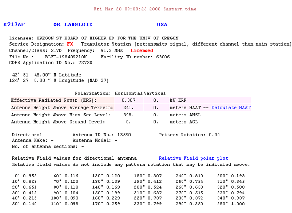
FCC Authorization 2008
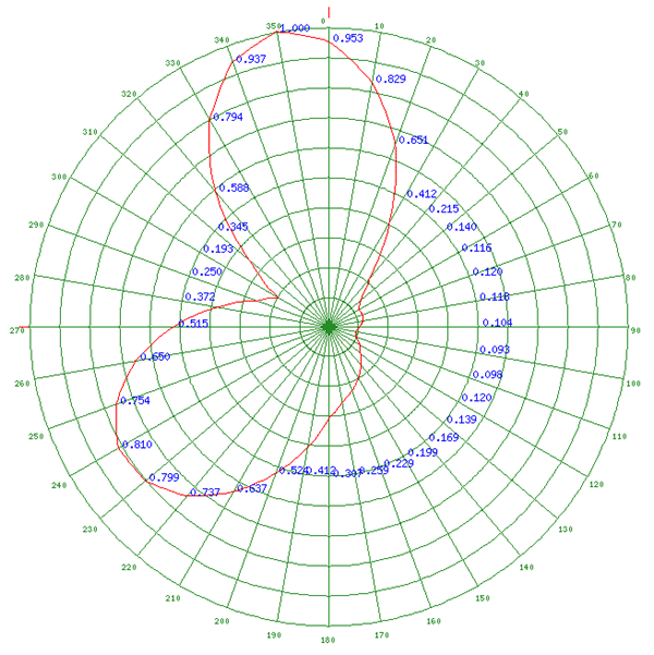
Relative Field Polar Plot 2008
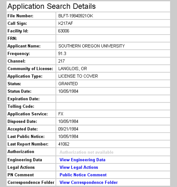
Initial License Grant 1984
Topographic Map
Sixes Quadrangle, U. S. Geological Survey
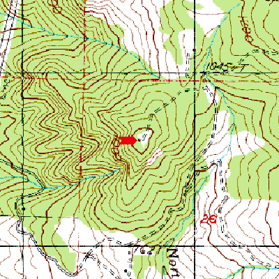
CONTOUR INTERVAL 40 FEET
Geographic Coordinates from the GPS: 42° 51' 53"N, 124° 26' 54"W (NAD27)
Antenna Height Above Mean Sea Level: 375 meters (1,230 feet)