Wedderburn Peak
Serving Gold Beach and Nesika Beach at 91.5 MHz
Location: one and one-half miles north of Gold Beach (geographic coordinates and map).
Pictures were taken in February 2008.
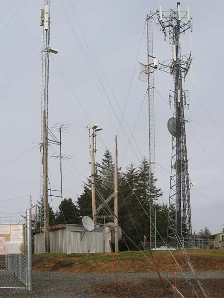
The Original Building
Only the wrinkled, silver-colored building existed at this location in 1982. Now, two large cell phone installations dominate the site: one at the right, and another beyond the picture on the left.
The wood pole on the left side of the translator building supports two side-mounted five-element yagi antennas. They are the KSOR transmitting antennas.
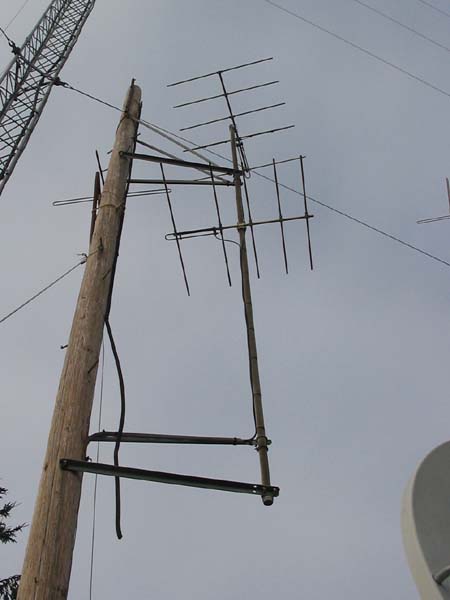
Transmitting Antennas
Considering 26 years in a corrosive environment, the antenna supports are holding up well. Five-foot arms hold the vertical pipe out from the pole. At the top, two steel straps restrain the pipe vertically. The coaxial cables connecting the antennas were taped to the steel pipe every foot or so. The black-plastic electrical tape remains strong.
Someone has cut loose a piece of coaxial cable and left it free to whip around in the wind. The turnstile antenna behind the wooden pole appears to be abandoned. (Neither is related to the KSOR translator.)
Initially, the translator received a signal from the Port Orford translator, 26 miles to the north. No remnant of the original receiving antenna could be identified.
Documents from the FCC Database
(http://www.fcc.gov/fcc-bin/fmq?list=0&facid=62995)
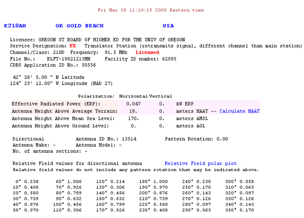
FCC Authorization 2008
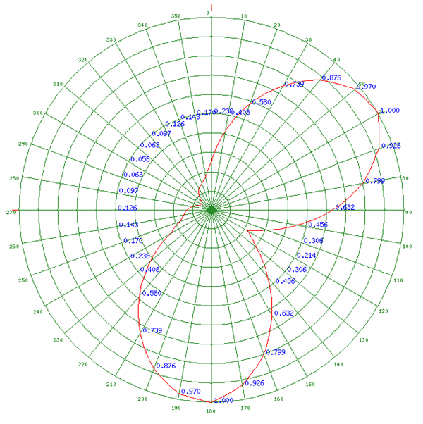
Relative Field Polar Plot 2008
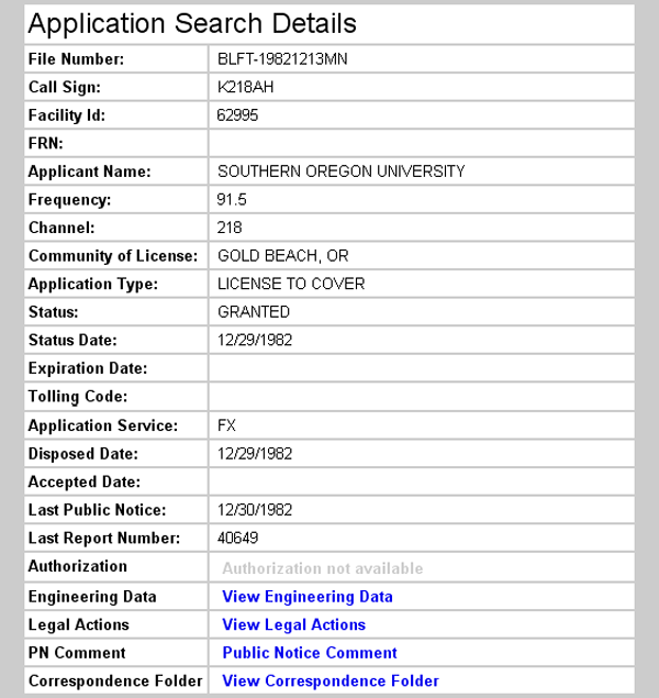
Initial License Grant 1982
Topographic Map
Gold Beach Quadrangle, U. S. Geological Survey
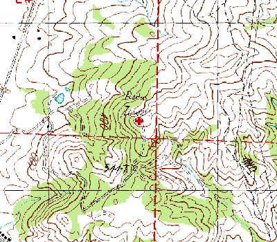
CONTOUR INTERVAL 40 FEET
Geographic Coordinates: 42° 26' 25"N, 124° 24' 57"W (NAD27)
Antenna Height Above Mean Sea Level: 221 meters (725 feet)