Chestnut Mountain
Serving Lincoln and Pinehurst at 91.9 MHz (later at 88.7 MHz)
Location: 2˝ miles northeast of the Green Springs Inn on Oregon Route 66 (geographic coordinates and map).
Pictures: the first series was taken in January 2007 and the last series, covering the demolition of the microwave station, in September and October 2007.
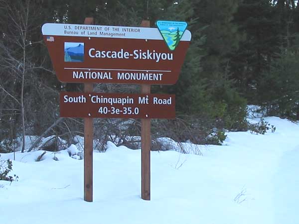
Summer Road
Bureau of Land Management (BLM) Road 40-3e-35.0 departs from the Hyatt Lake Road one-half mile north of the Green Springs Inn. Chestnut Mountain is also known as South Chinquapin Mountain.
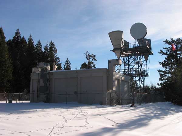
Qwest Microwave Station
This facility served as a microwave radio relay between Mt. Baldy, east of Phoenix, and Hamaker Mountain, southwest of Klamath Falls. For several decades, it carried a large portion of the incoming and outgoing telephone calls for the greater Medford area.
This area on the west side was left for vehicle parking. The KSOR translator was installed 150 feet east of the building.
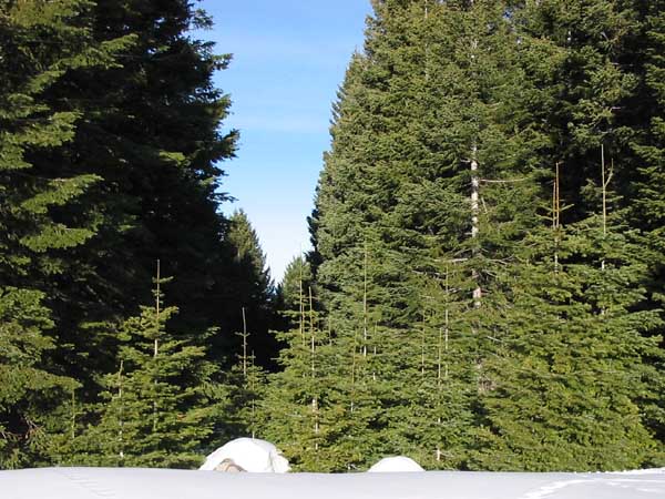
Microwave Corridor
At the time we installed the translator, Mt. Baldy was visible from this viewpoint. When the relay station was operating, this corridor was trimmed to maintain a clear path. Microwave signals cannot travel through foliage as do FM broadcast signals.
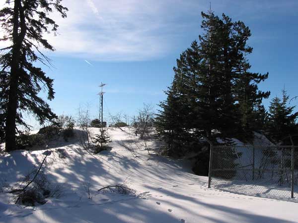
Rock Pile
The translator installation took place during the summer when there was no snow. We cut brush and moved large rocks to provide access. KSOR's Dodge Power Wagon carried equipment and supplies across the rock pile, to the north (left) of the KSYS translator, to the installation site beyond the eastern edge.
The View East
Looking east across the rock pile, the KSYS translator is in the foreground and the KSOR translator in the background. Stukel Mountain appears on the horizon just to the left of the KSOR antenna tower and Hamaker Mountain just to the right, but is partially hidden.
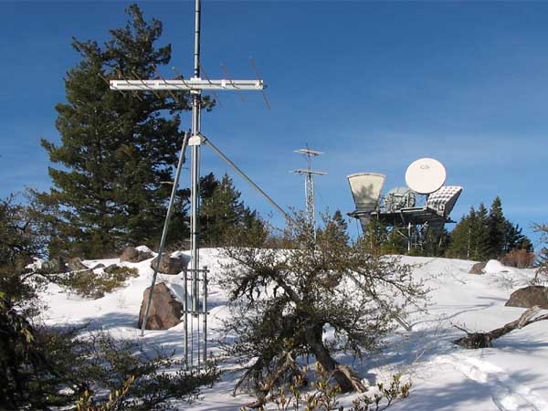
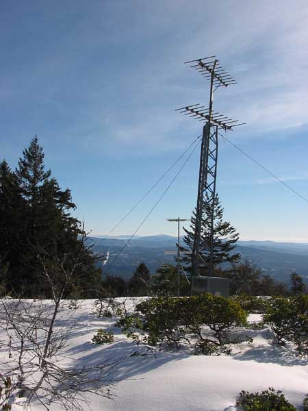
KSOR Transmitting Antennas
The translator itself is in a concrete vault beneath the snow. A one-half-inch steel conduit sneaks between the rocks and under the brush to the receiving antenna in the distance (not visible). Because this site is little more than a pile of large rocks, we anchored the diagonal braces with concrete.
Access to the KSOR Translator
Looking from the south, the steep descent to the translator site can be appreciated. We backed the Dodge Power Wagon down to the site with cement, gravel, water, pre-made plywood forms, tower components and tools. Later, when attempting to drive out, the driveline twisted like a corkscrew. The power take-off winch was the only thing available to pull the truck back to the top of the rock pile. We removed the damaged rear driveline and returned to Ashland with front-wheel drive only. That was a long, hard day.
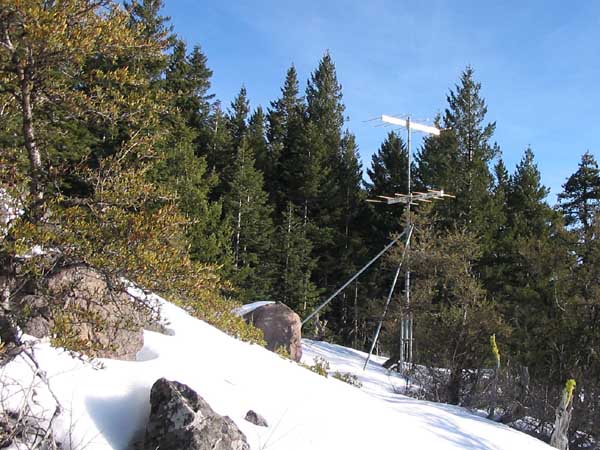
KSYS Translator
The lower antenna picked up TV Channel 8 from King Mountain and the upper antenna transmitted to the communities of Lincoln and Pinehurst on Channel 13. It had been in place for some time before the KSOR translator was installed.

KSOR Receiving Antenna
A 37-foot tower supports the receiving antenna for the KSOR translator, as well as its enclosed meter base for AC power.
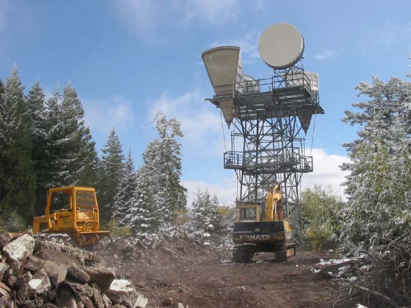
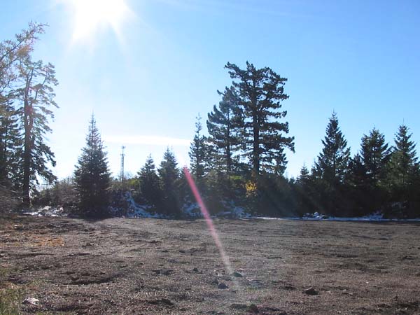
Demolition of the Qwest Microwave Station
Fiber-optic cable became more cost-effective than upgrading and maintaining this facility. The contractor said that he had seven microwave stations to demolish that summer (2007).
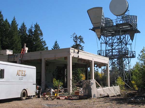
September 27, 2007
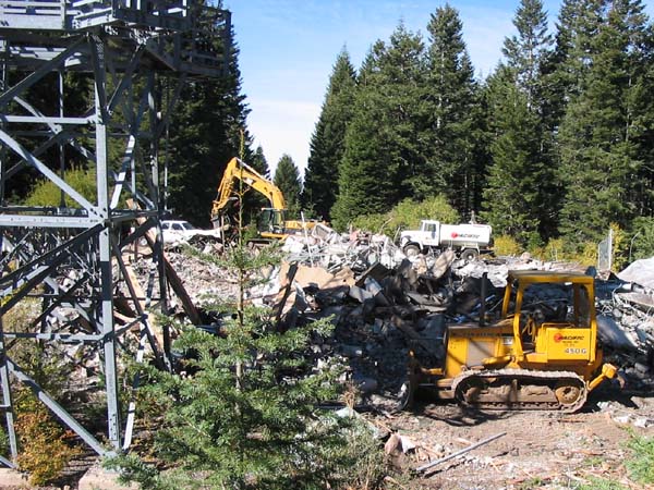
October 2, 2007
October 5, 2007
October 22, 2007
The microwave station is gone. The KSYS translator remains. One of KSOR's transmitting antennas is barely visible at the left.
Documents from the FCC Database
(http://www.fcc.gov/fcc-bin/fmq?list=0&facid=62972)
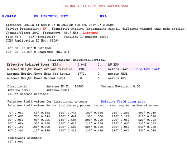
FCC Authorization 2008
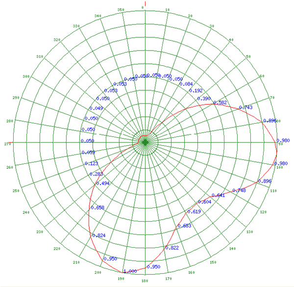
Relative Field Polar Plot 2008
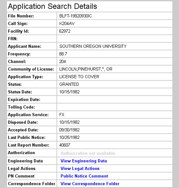
Initial License Grant 1982
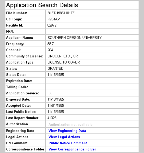
Frequency Change 1985
Translator Operating Frequency
The Chestnut Mountain translator first operated at 91.9 MHz. The FCC Search Details show a license granted on October 15, 1982 with an operating frequency of 88.7 MHz, which is incorrect. The operating frequency did change to 88.7 MHz, however, on November 13, 1985 (see FCC Search Details).
The circumstances of the frequency change are presented on the Stukel Mountain page under Translator Operating Frequency.
Topographic Map
Hyatt Reservoir Quadrangle, U. S. Geological Survey
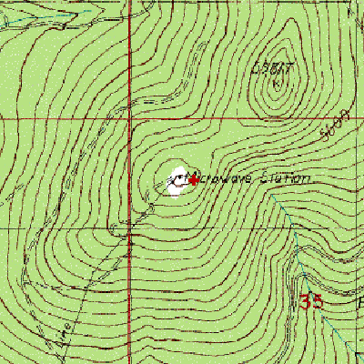
CONTOUR INTERVAL 40 FEET
Geographic Coordinates from the GPS: 42° 08' 22"N, 122° 26' 24"W (NAD27)
Antenna Height Above Mean Sea Level: 1,772 meters (5,814 feet)
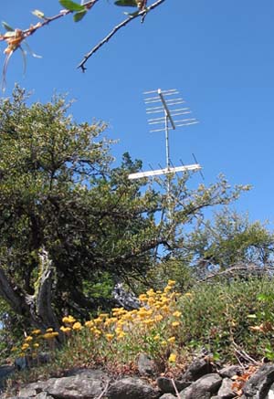
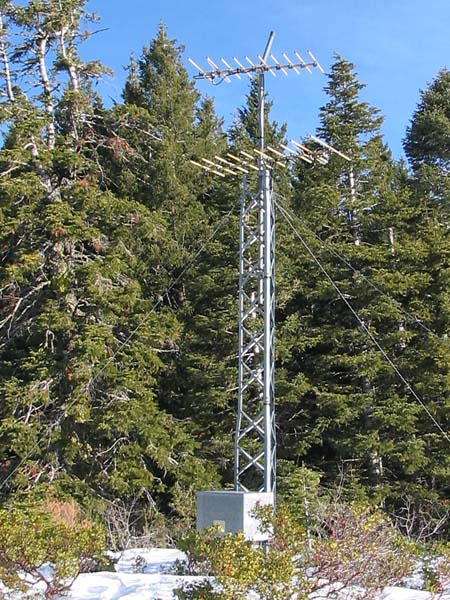
Transmitting Antennas – August 2008