Stukel Mountain
Serving Klamath Falls, Altamont, Merrill and Bonanza at 88.7 MHz
(later at 91.9 MHz)
Location: twelve miles southeast of Klamath Falls (geographic coordinates and map).
Pictures: Todd Cory provided pictures from April 1994. Others were taken in June 2008.
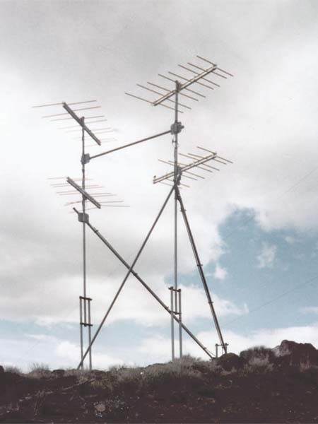
Transmitting Antennas – 1994
There were four transmitting antennas. On the left, the upper antenna was directed to Klamath Falls and the lower antenna to Merrill. The two antennas on the right worked together to increase the signal strength to Bonanza and to the Lakeview translator on Grizzly Peak, 52 miles to the east.
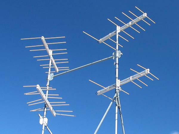
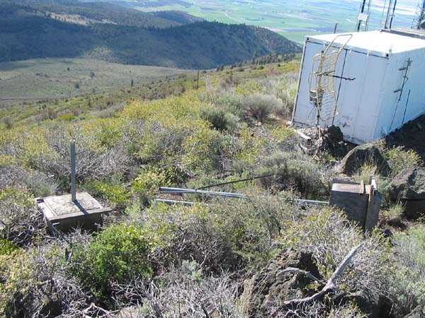
Transmitting Antennas – 2008
These antennas have suffered serious damage.
Yes, no doubt the CLFMs on Stukel got this with ice, probably from the KSKF tower, which is upwind from the translator output antennas. They are tough antennas, but 100 MPH wind-driven chunks of ice will destroy anything. I remember one time when I was up there replacing a nitrogen tank on the KSKF 1-7/8" Heliax, and the roof tiles were flying through the air like tidily-winks. The wind was THAT strong. . . (Todd Cory, email, February 12, 2008)
Log-periodic arrays will often continue to function after being damaged. It is noteworthy that these antennas were still broadcasting effectively.
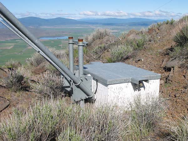
Translator Vault – 2008
The translator was housed in a concrete vault. The thermal mass of the concrete stabilized the temperature of the equipment, and being in the ground minimized the extremes of heat in the summer and cold in the winter. Reduced thermal cycling improved the reliability of electronic components.
Wanting the translator placed below the surface of the ground, three of us dug through the rocks to a depth of 36 inches with hand tools. It was strenuous work. Years later, the vault was extended to its present height.
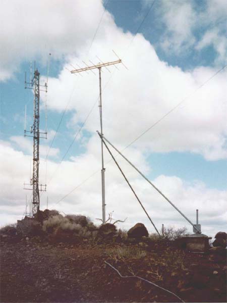
Receiving Antenna – 1994
Located 160 feet north of the transmitting antennas, this antenna picked up the KSOR signal from Chestnut Mountain, 42 miles to the west.
The large antenna tower in the distance is to the north. The guy lines running from the lower left of the picture supported a tower that was much closer on the south side. Wind-blown ice from this tower is the likely cause of the missing element on KSOR's antenna.
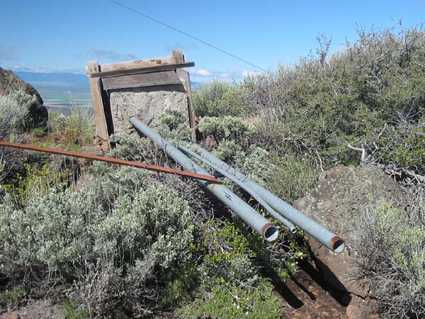
Receiving Antenna Debris – 2008
The tower has been toppled and disassembled. One of the diagonal-brace anchors now supports someone else's antenna.
Anatomy of the Modular Tower System
10˝-foot lengths of 2-inch pipe formed the lower section of the antenna mast. Small conduit protected the coaxial cable continuously between the antenna and the translator vault.
Penetrating the ground was difficult. After the work of digging through rock for the vault, we were happy to place the concrete anchors on top of the ground. For pouring the concrete, we used simple plywood forms held in place with large rocks, of which there was no shortage. The tower was extremely strong after the components were bolted together.
Documents from the FCC Database
(http://www.fcc.gov/fcc-bin/fmq?list=0&facid=62993)
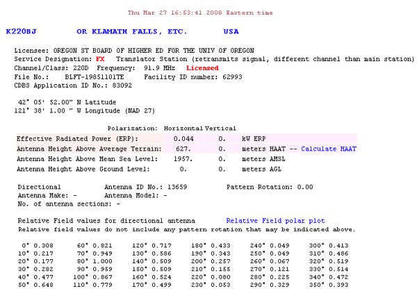
FCC Authorization 2008
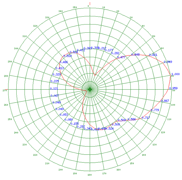
Relative Field Polar Plot 2008
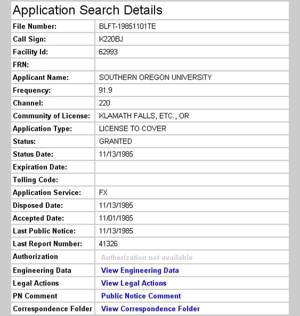
Frequency Change 1985
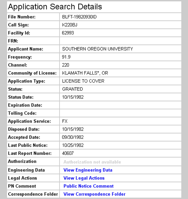
Initial License Grant 1982
Translator Operating Frequency: Stukel and Chestnut Mountains
The FCC Search Details for Stukel Mountain (immediately above) incorrectly record 91.9 MHz as the operating frequency for the translator license granted on October 15, 1982. The Stukel translator first operated at 88.7 MHz while receiving a signal from Chestnut Mountain at 91.9 MHz.
The operating frequency at both Stukel and Chestnut did change later as result of the KJSN-FM transmitter being moved to Stukel. At 92.5 MHz, KJSN would have operated on the third-adjacent channel to the 91.9 MHz signal being received from Chestnut. With the KJSN antenna little more than 250 feet away from the receiving antenna, we felt there was a strong possibility of interference. We considered it imperative to change the frequency of the signal coming from Chestnut.
The Klamath County Planning and Zoning Department held a public hearing for the KJSN-FM Special Use Permit. Before the Hearing Officer, KSOR provided testimony acknowledging that the primary-use license of KJSN had precedence over KSOR's translator license. We explained the necessity of changing the translator frequencies in order to maintain operation. Because of the station's substantial listener base in Klamath Falls, we asked only that we be given sufficient time to obtain FCC authorization and to purchase crystals for the translator before KJSN went on the air.
Being unhappy about any possible delay, the licensee of KJSN filed a Petition for Declaratory Ruling with the FCC. The FCC responded with the Memorandum Opinion and Declaratory Ruling that was adopted on October 29, 1985 and released on November 4, 1985.
The FCC Search Details for the Stukel translator correctly show a license grant on November 13, 1985 for operation on 91.9 MHz (above). On the same date, a license was granted for the Chestnut Mountain translator for operation on 88.7 MHz (Chestnut Mountain page). The FCC's Memorandum Opinion and Declaratory Ruling for KJSN had been adopted 15 days earlier.
This incident had an outcome that was felt across the nation: the FCC made it clear that local jurisdictions may not infringe its authority.
Topographic Map
Lost River Quadrangle, U. S. Geological Survey
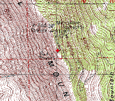
CONTOUR INTERVAL 20 FEET
Geographic Coordinates from the GPS: 42° 05' 51"N, 121° 37' 59"W (NAD27)
Antenna Height Above Mean Sea Level: 1,957 meters (6,421 feet)