Westport Peak
Serving Coos Bay, North Bend and portions of Bandon at 89.1 MHz
Location: six miles south of Coos Bay (geographic coordinates and map).
Pictures were taken in March 2008.
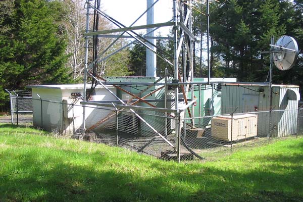
The Radio Facility
The two green buildings, the gray building, the security fence and the gray monopole on the far side were not there. There was only the cement-block building at the left and the three-legged tower.
There were no trees. The hilltop had been clear-cut, and the regrowth was not yet prominent. The Pacific Ocean and part of Coos Bay could be seen in the distance.
That December day when the installation began, there was snow on the ground. Being only six miles from the ocean, this was a surprise.
The owner of the facility placed three restrictions on the translator: it must be placed outside the building, none of the antennas could be more than 50 feet above ground, and the receiving antenna must also be mounted on the tower.
The Translator
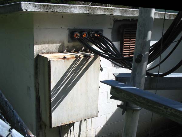
Electronic equipment inside this concrete building would have been isolated from large temperature variations due to the building's thermal mass. Because there was not enough heat generated to require ventilation, the interior was also isolated from the corrosive salt-air environment.
Unfortunately, the translator had to be mounted outside, on the south side of the building, with direct exposure to the sun. It needed protection from excessive heat and heavy rains. A small muffin fan circulated fresh air through vents in the bottom of the box. The circuit boards were sealed to minimize contact with the corrosive air.
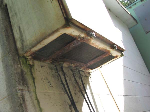
Salt-Air Corrosion
The metal box used to protect and cool the translator was the same as that used at Crescent City. There was severe corrosion at both sites.
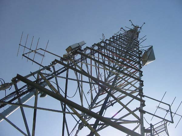
The Tower
The owner said it was 450 feet tall. I found no reason to dispute the matter. Before the translator was installed, there were only a few communications antennas at the top. The horizontal pieces of steel angle are recent additions. Originally, the tower had only the diagonal braces.
The five-element yagi on the left broadcast northwards to Coos Bay and North Bend. The yagi on the right side broadcast southwards to Bandon and provided the signal for the translator located there.
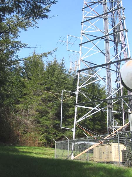
The South Leg of the Tower
The five-element transmitting yagi was 50 feet above the ground. Below it, the ten-element receiving yagi picked up the Iron Mountain translator from 43 miles to the south. With only 25 feet separating the antennas, the translator's output signal far exceeded the receiver overload limit. We used a radiofrequency filter combined with an attenuator to protect the receiver from overload.
Documents from the FCC Database
(http://www.fcc.gov/fcc-bin/fmq?list=0&facid=63016)
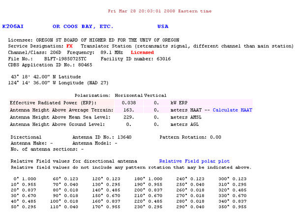
FCC Authorization 2008
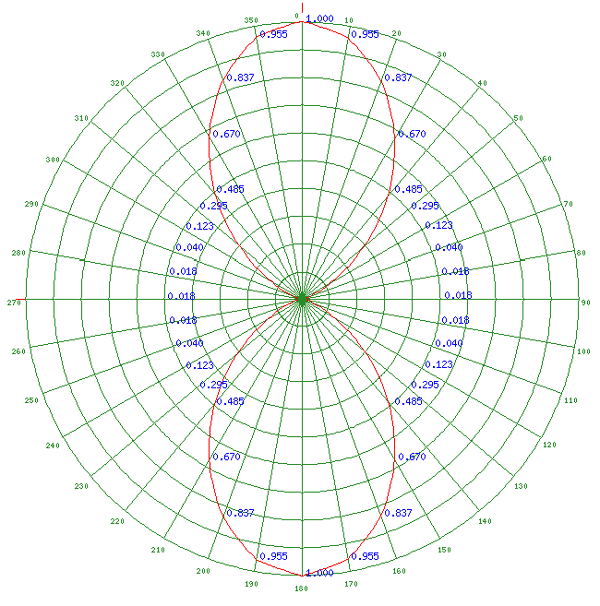
Relative Field Polar Plot 2008
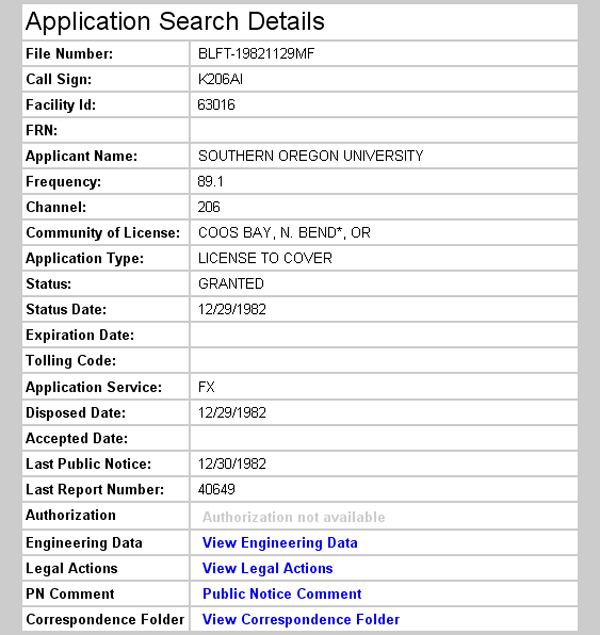
License Grant 1982
Topographic Map
Coos Bay Quadrangle, U. S. Geological Survey
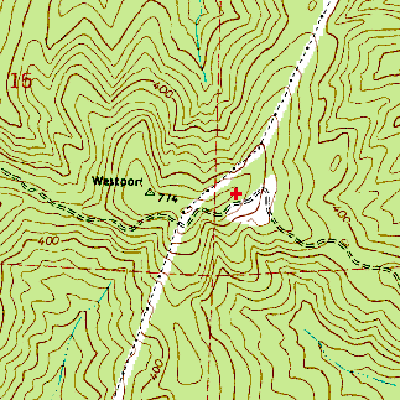
CONTOUR INTERVAL 40 FEET
Geographic Coordinates from the GPS: 43° 18' 43"N, 124° 14' 12"W (NAD27)
Antenna Height Above Mean Sea Level: 223 meters (731 feet)
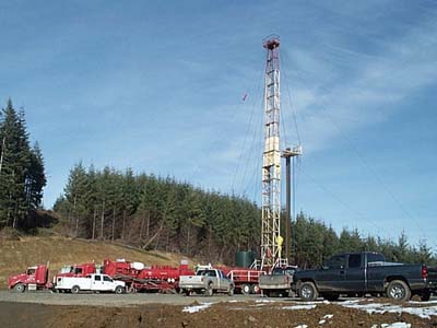
Drilling for Methane – 2006
The Coos Bay Coal-Bed Methane Project drilled a number of test holes near the translator site. The photo is from the Torrent Energy Corporation website (http://www.torrentenergy.com), September 10, 2008.
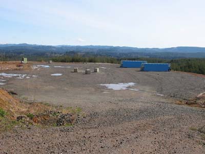
Drilling Field – March 2008
The road to the translator appears in the foreground. This drilling field is about 1000 feet southeast of the translator site. Google Maps (satellite view, http://maps.google.com, September 10, 2008) revealed three more drilling fields to the south and one to the west that were not seen while traveling to the translator site.