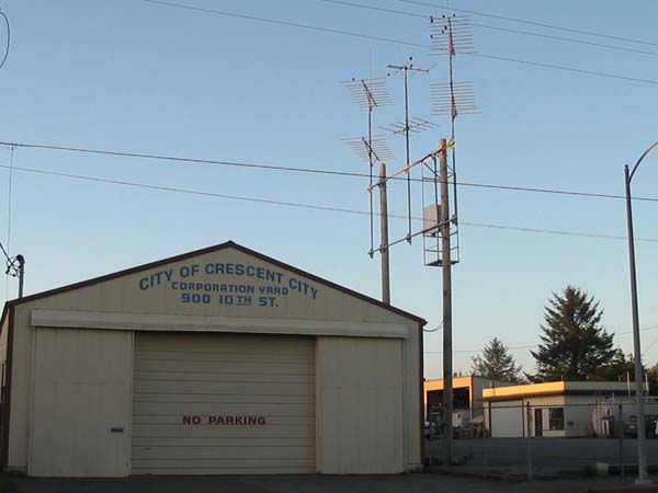
Crescent City Corporation Yard
Location: Crescent City (geographic coordinates and map).
Pictures were taken in February 2008.
Transmitting Antennas
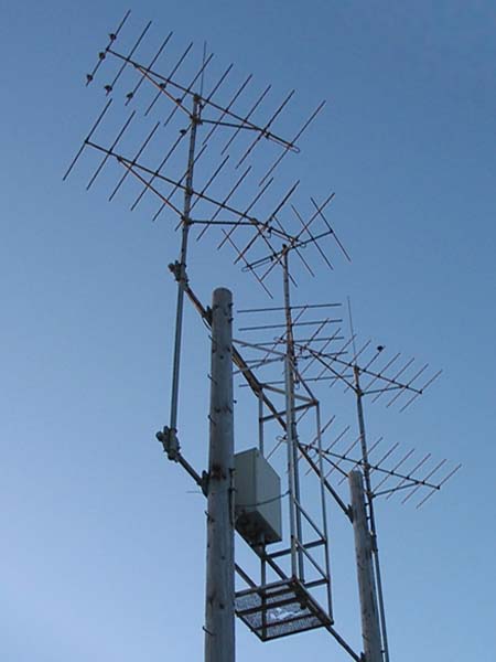
Crescent City set two wooden poles for the station. The antenna structure was made from five standard lengths of two-inch galvanized pipe, and ten square plates. A cage held the steel enclosure for the translator and provided a place for the engineer to stand while working.
The City also set a single wooden pole at the far end of the building. The receiving antenna picked up the signal from Camp Six, 17 miles to the east.
Two ten-element yagi transmitting antennas sent a signal north along the coast, and two ten-element antennas sent a signal south. The two five-element antennas provided a signal to the residents nestled in the foothills east of town. The business district received a generous signal from the translator at Camp Six.
Salt-Air Corrosion
Being less than a mile from the Pacific Ocean, this is a corrosive environment. After 25 years, the expanded steel grating is dangerously corroded, and the structural integrity of the cage is suspect.
I remember visiting that site and standing in that cage. The steel was VERY corroded and it felt "dicey" working there. The metal box that held the translator was also very rusty. The checkout proved that everything was working great. . . even in that corrosive environment, although someday not too far off the thing will probably fall off the pole from rust. (Todd Cory, email, February 13, 2008)
The translator housing was the same as that used at Westport Peak for the Coos Bay translator. There has been severe corrosion at both sites.
Documents from the FCC Database
(http://www.fcc.gov/fcc-bin/fmq?list=0&facid=62069)
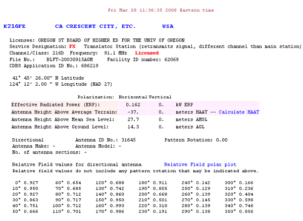
FCC Authorization 2008
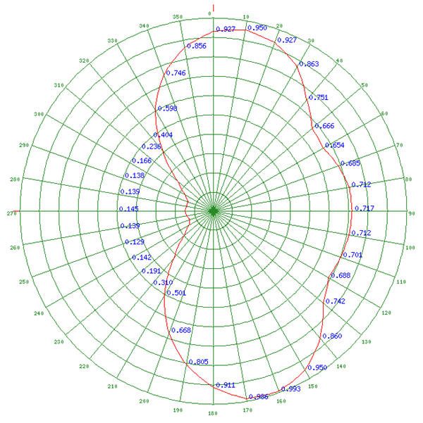
Relative Field Polar Plot 2008
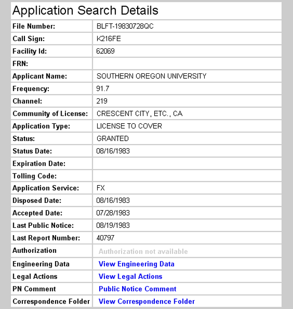
Initial License Grant 1983
The initial license grant shows an operating frequency of 91.7 MHz. This is at odds with other records in the FCC's Database. Three applications preceding the initial license grant and two applications following it record 91.9 MHz as the operating frequency. (Application Search Results: http://fjallfoss.fcc.gov/cgi-bin/ws.exe/prod/cdbs/pubacc/prod/app_list.pl?Facility_id=62069)
Topographic Map
Crescent City Quadrangle, U. S. Geological Survey
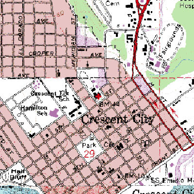
CONTOUR INTERVAL 10 METERS
Geographic Coordinates: 41° 45' 26"N, 124° 12' 02"W (NAD27)
Antenna Height Above Mean Sea Level: 27 meters (89 feet)