Fielder Mountain (Solar)
Serving Grants Pass
Location: five miles east of Grants Pass and one-half mile south of the Fielder Mountain summit (geographic coordinates and map).
The FCC Database has no record of this translator.
Pictures were taken in April 2008.
Learning from Experience
This was KSOR's first translator. We started with the rather naive assumption that the installation would require a minimum of equipment and only a modest expenditure of effort. We envisioned taking a translator into the mountains, connecting it to receiving and transmitting antennas, and turning it on. The simplicity of our premise was appealing.
We selected a likely spot on a map and set out by automobile to see it firsthand. The mountain road was exceedingly rough and steep, so we parked and hiked up to the site. There were no power lines, no radio buildings and only a washed-out Jeep trail for access. At that point, it dawned on us that the installation might not be so easy.
An alternative power source was needed. We contacted a manufacturer to obtain information about solar panels and batteries. The project was getting more complicated.
Construction of a cement block building and a substantial tower was out of the question. Listener support was growing, but it was still important to limit expenditures. At a military surplus store, we found three ammunition boxes that would suitably protect the translator and batteries. We also acquired a few pieces of steel angle and pipe. From this odd collection of components, we made a simple structure that would support a transmitting antenna and the solar panels. We included a locking bar to prevent access to the translator and batteries.
By now, we had a truckload of equipment ready for the translator site. The college motor pool did not have a four-wheel-drive vehicle. We talked with several of the students at the radio station. One volunteered his four-wheel-drive pickup.
We were buoyed with excitement as we began the ascent of Fielder Mountain. The terrain was rugged and beautiful, but the pleasure of the moment was short-lived. On a steep grade, the truck slid into a deep rut. Rescuing the four by four was a major headache. This was not the end of difficulties.
Eventually, we arrived at the translator site. We assembled the structure and buried it just deep enough to keep the antenna and solar panel supports upright. At the highest point, the antenna was only a few feet beyond one's reach, so it did not need the additional support of guy wires. Students did the digging with picks and shovels.
When we turned on the T-99FM translator, it was a great disappointment. The translator's output interfered with the KSOR signal it was trying to pick up from Mt. Baldy. We had to move the receiving antenna to the far side of the hill. We thought it was operating well when we discovered that it was also rebroadcasting KTMT-FM – even stronger than KSOR! We ordered a radiofrequency filter and waited impatiently for it to be delivered. Finally, the translator was broadcasting properly while delivering a power of one watt to the transmitting antenna.
Later, following a long period of undisturbed operation, we received a report of signal failure. What we found at the site was distressing: someone had blasted the solar panels with a shotgun. That strengthened our resolve to find a new home for the translator.
After several years of operation, this site was decommissioned, and a new XL-FM translator was installed at Albert's Peak. Now, 30 years later, the summit of Fielder Mountain is populated with antenna towers and radio buildings, but there is no trace of the original translator.
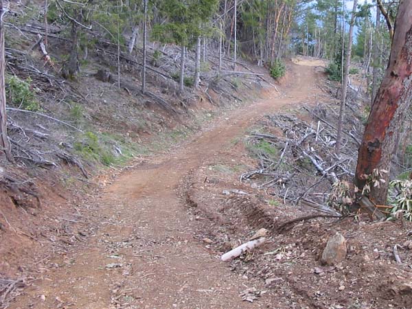
The Access Road
Three decades ago, this road was a primitive trail. The steepest sections had deep ruts that made it impassable to most vehicles. The improvements seen here came later with the construction of a network of logging roads. At present, this road is not open to the public.
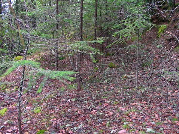
The Old Road
Construction of the logging roads cut off and isolated this section of the old Jeep trail. No wheels have passed here in many years.
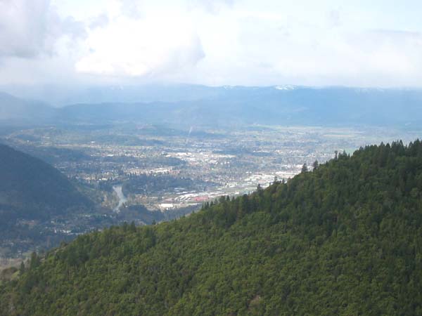
The Signal Path to Grants Pass
The one-watt translator had about the same power as a handheld flashlight. At night, if a listener could see a flashlight at this location, he or she could also hear the translator. Because significant areas of Grants Pass are blocked from view, this site was less than ideal.
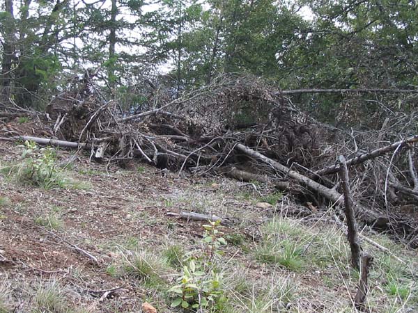
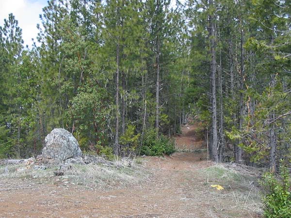
The Slash Pile
The translator was 200 feet west of the ridgeline (Tx on the map). The structure with the solar panels, CL-FM transmitting antenna, translator and batteries was located here. The site is now covered with the debris of logging. At the time of the installation, trees and brush were less abundant, perhaps still recovering from a fire.
The Receiving Antenna
KSOR's signal from Mt. Baldy had a direct path to the ridgeline. Reception was excellent. The receiving antenna was set just far enough east (to the right), and kept low enough to avoid the direct pick up of the translator's own output signal (from the left, below). It was a Scala HDCA-10 placed only five feet above ground (Rx on the map, below).
Topographic Map
Rogue River Quadrangle, U. S. Geological Survey
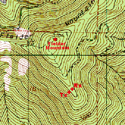
CONTOUR INTERVAL 40 FEET
Geographic Coordinates for Tx: 42° 26' 27"N, 123° 12' 45"W (NAD27)
Antenna Height Above Mean Sea Level: 1,027 meters (3,370 feet)