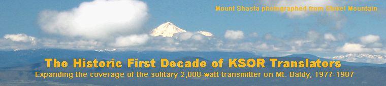
|
Context
Map
Engineering
Sites
Northwestern
 Fielder Mountain (Solar) – Grants Pass (decommissioned) Fielder Mountain (Solar) – Grants Pass (decommissioned)
Albert's Peak – Grants Pass, Merlin and Pleasant Valley
Northwestern Tree
Iron Mountain (Solar) – Port Orford, Coos Bay and Coquille
 Coast Guard Hill – Port Orford Coast Guard Hill – Port Orford
 Wedderburn Peak - Gold Beach and Nesika Beach Wedderburn Peak - Gold Beach and Nesika Beach
Stonecypher Butte – Sixes, Denmark and Langlois
Westport Peak - Coos Bay and North Bend
Bandon City Park - Bandon
Jefferson School – Coquille
Northern Chain
Canyon Mountain – Canyonville, Riddle, Tri-City and Myrtle Creek
Mount Nebo – Roseburg
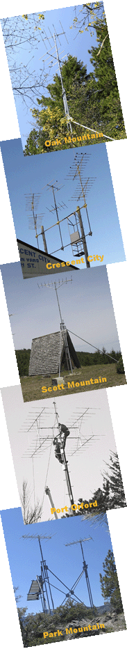
Scott Mountain – Sutherlin and Glide
 Kenyon Mountain – Camas Valley Kenyon Mountain – Camas Valley
Northeastern Chain
Walker Mountain – La Pine, Gilchrist, Chemult and Beaver Marsh
Agency Hill – Chiloquin
Tree with Branches to the East and South
Chestnut Mountain – Lincoln and Pinehurst
Stukel Mountain – Klamath Falls, Altamont, Merrill and Bonanza
Loma Linda Drive – Klamath Falls and Altamont
Grizzly Peak (Solar) – Lakeview
Park Mountain (Solar) – Weed, Lake Shastina and Gazelle
Grey Butte – Mt. Shasta City and McCloud
Oak Mountain – Big Bend and Bush Bar
Southern
Central Hall, SOSC – South Ashland and Dead Indian Memorial Road
Paradise Craggy (Solar) – Yreka
Southwestern Chain
Eight Dollar Mountain – Cave Junction, Kerby and Selma
Camp Six (Solar) – Gasquet and Crescent City
Crescent City Corporation Yard – Crescent City
The Harbor Hills – Brookings and Harbor
Observations
Anecdotes
Except where otherwise noted, John Patton is the author of these pages.
Copyright © 2008 John Patton
|